
~ Witham Mtn ME topo map, 1:24000 scale, 7.5 X 7.5 Minute, Historical, 1989, updated 1989
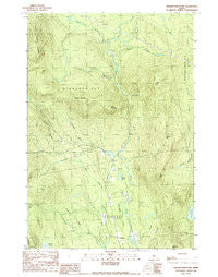
Witham Mtn, Maine, USGS topographic map dated 1989.
Includes geographic coordinates (latitude and longitude). This topographic map is suitable for hiking, camping, and exploring, or framing it as a wall map.
Printed on-demand using high resolution imagery, on heavy weight and acid free paper, or alternatively on a variety of synthetic materials.
Topos available on paper, Waterproof, Poly, or Tyvek. Usually shipping rolled, unless combined with other folded maps in one order.
- Product Number: USGS-5535825
- Free digital map download (high-resolution, GeoPDF): Witham Mtn, Maine (file size: 18 MB)
- Map Size: please refer to the dimensions of the GeoPDF map above
- Weight (paper map): ca. 55 grams
- Map Type: POD USGS Topographic Map
- Map Series: HTMC
- Map Verison: Historical
- Cell ID: 49601
- Scan ID: 103121
- Imprint Year: 1989
- Woodland Tint: Yes
- Aerial Photo Year: 1985
- Edit Year: 1989
- Field Check Year: 1987
- Datum: NAD27
- Map Projection: Transverse Mercator
- Provisional map: Yes
- Map published by United States Geological Survey
- Map Language: English
- Scanner Resolution: 600 dpi
- Map Cell Name: Witham Mountain
- Grid size: 7.5 X 7.5 Minute
- Date on map: 1989
- Map Scale: 1:24000
- Geographical region: Maine, United States
Neighboring Maps:
All neighboring USGS topo maps are available for sale online at a variety of scales.
Spatial coverage:
Topo map Witham Mtn, Maine, covers the geographical area associated the following places:
- Bald Mountain - Lexington Township - Plantation of Highland - Stewart Mountain - Highland School - Witham Mountain - Chandler Hill - Peaked Hill - Highland Cemetery - Little Michael Stream - Howard Hill - Stony Brook - Schoolhouse Brook - Hutchins Hill - Spruce Pond - Michael Stream - Moores Pond - Burnt Hill - Churchill Brook - Briggs Hill - Pease Brook - Safford Pond - The Ledges - Bear Brook - Barker Brook - Britenell Brook
- Map Area ID: AREA45.12545-70.125-70
- Northwest corner Lat/Long code: USGSNW45.125-70.125
- Northeast corner Lat/Long code: USGSNE45.125-70
- Southwest corner Lat/Long code: USGSSW45-70.125
- Southeast corner Lat/Long code: USGSSE45-70
- Northern map edge Latitude: 45.125
- Southern map edge Latitude: 45
- Western map edge Longitude: -70.125
- Eastern map edge Longitude: -70


