
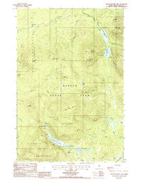
~ Wassataquoik Lake ME topo map, 1:24000 scale, 7.5 X 7.5 Minute, Historical, 1988, updated 1988
Wassataquoik Lake, Maine, USGS topographic map dated 1988.
Includes geographic coordinates (latitude and longitude). This topographic map is suitable for hiking, camping, and exploring, or framing it as a wall map.
Printed on-demand using high resolution imagery, on heavy weight and acid free paper, or alternatively on a variety of synthetic materials.
Topos available on paper, Waterproof, Poly, or Tyvek. Usually shipping rolled, unless combined with other folded maps in one order.
- Product Number: USGS-5535663
- Free digital map download (high-resolution, GeoPDF): Wassataquoik Lake, Maine (file size: 19 MB)
- Map Size: please refer to the dimensions of the GeoPDF map above
- Weight (paper map): ca. 55 grams
- Map Type: POD USGS Topographic Map
- Map Series: HTMC
- Map Verison: Historical
- Cell ID: 47623
- Scan ID: 103079
- Imprint Year: 1988
- Woodland Tint: Yes
- Aerial Photo Year: 1982
- Edit Year: 1988
- Field Check Year: 1985
- Datum: NAD27
- Map Projection: Transverse Mercator
- Provisional map: Yes
- Map published by United States Geological Survey
- Map Language: English
- Scanner Resolution: 600 dpi
- Map Cell Name: Wassataquoik Lake
- Grid size: 7.5 X 7.5 Minute
- Date on map: 1988
- Map Scale: 1:24000
- Geographical region: Maine, United States
Neighboring Maps:
All neighboring USGS topo maps are available for sale online at a variety of scales.
Spatial coverage:
Topo map Wassataquoik Lake, Maine, covers the geographical area associated the following places:
- Pinnacle Ridge - Little Peaked Mountain - South Pogy Mountain - Squirt Dam Mountain - Howe Brook - T5 R9 WELS - Gifford Brook - Pogy Pond - Little Wassataquoik Lake - Upper South Branch Pond - Snub Pitch - Sable Mountain - North Ridge - Green Falls - Black Brook Farm - Big Peaked Mountain - Wassataquoik Tote Road - Black Cat Mountain - Center Ridge - Bell Pond - Pogy Notch - Black Brook Mountains - Inscription Rock - North Branch Trout Brook - Draper Pond - North Pogy Mountain - Lord Mountain - Howe Peak - Old Pogy Road - Wassataquoik Lake - Long Pond - Maher Pond - Baxter State Park - South Branch Pond Campground - Kennedy Brook - Snub Brook - Dry Gorge - South Branch Trout Brook - Six Ponds - Lower South Branch Pond - Weed Pond - Deep Pond
- Map Area ID: AREA46.12546-69-68.875
- Northwest corner Lat/Long code: USGSNW46.125-69
- Northeast corner Lat/Long code: USGSNE46.125-68.875
- Southwest corner Lat/Long code: USGSSW46-69
- Southeast corner Lat/Long code: USGSSE46-68.875
- Northern map edge Latitude: 46.125
- Southern map edge Latitude: 46
- Western map edge Longitude: -69
- Eastern map edge Longitude: -68.875


