
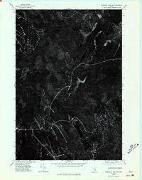
~ Wabassus Lake SE ME topo map, 1:24000 scale, 7.5 X 7.5 Minute, Historical, 1975, updated 1980
Wabassus Lake SE, Maine, USGS topographic map dated 1975.
Includes geographic coordinates (latitude and longitude). This topographic map is suitable for hiking, camping, and exploring, or framing it as a wall map.
Printed on-demand using high resolution imagery, on heavy weight and acid free paper, or alternatively on a variety of synthetic materials.
Topos available on paper, Waterproof, Poly, or Tyvek. Usually shipping rolled, unless combined with other folded maps in one order.
- Product Number: USGS-5535629
- Free digital map download (high-resolution, GeoPDF): Wabassus Lake SE, Maine (file size: 9 MB)
- Map Size: please refer to the dimensions of the GeoPDF map above
- Weight (paper map): ca. 55 grams
- Map Type: POD USGS Topographic Map
- Map Series: HTMC
- Map Verison: Historical
- Cell ID: 29880
- Scan ID: 807263
- Imprint Year: 1980
- Aerial Photo Year: 1975
- Datum: NAD27
- Map Projection: Transverse Mercator
- Orthophoto: Quad
- Map published by United States Geological Survey
- Keywords: Nonstandard Press Run
- Map Language: English
- Scanner Resolution: 508 dpi
- Map Cell Name: Monroe Lake
- Grid size: 7.5 X 7.5 Minute
- Date on map: 1975
- Map Scale: 1:24000
- Geographical region: Maine, United States
Neighboring Maps:
All neighboring USGS topo maps are available for sale online at a variety of scales.
Spatial coverage:
Topo map Wabassus Lake SE, Maine, covers the geographical area associated the following places:
- Second Lake - T43 MD BPP - Thompson Brook - T37 MD BPP - Hay Meadows - Third Lake - Fletcher Brook - Lanpher Brook - First Machias Lake - Horse Lake - South Branch Little Musquash Stream - Getchel Mountain - Eastern Arm Third Machias Lake - Second Lake Ridge - Fourth Lake - King Brook - Second Lake Dam - Monroe Brook - Norway Island - Midland Flats - Monroe Lake - Magazine Brook - Towers Brook - Little Musquash Lake - North Branch Little Musquash Stream - Heath Brook
- Map Area ID: AREA45.12545-67.875-67.75
- Northwest corner Lat/Long code: USGSNW45.125-67.875
- Northeast corner Lat/Long code: USGSNE45.125-67.75
- Southwest corner Lat/Long code: USGSSW45-67.875
- Southeast corner Lat/Long code: USGSSE45-67.75
- Northern map edge Latitude: 45.125
- Southern map edge Latitude: 45
- Western map edge Longitude: -67.875
- Eastern map edge Longitude: -67.75


