
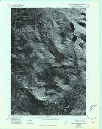
~ Traveler Mountain SW ME topo map, 1:24000 scale, 7.5 X 7.5 Minute, Historical, 1975, updated 1981
Traveler Mountain SW, Maine, USGS topographic map dated 1975.
Includes geographic coordinates (latitude and longitude). This topographic map is suitable for hiking, camping, and exploring, or framing it as a wall map.
Printed on-demand using high resolution imagery, on heavy weight and acid free paper, or alternatively on a variety of synthetic materials.
Topos available on paper, Waterproof, Poly, or Tyvek. Usually shipping rolled, unless combined with other folded maps in one order.
- Product Number: USGS-5535541
- Free digital map download (high-resolution, GeoPDF): Traveler Mountain SW, Maine (file size: 13 MB)
- Map Size: please refer to the dimensions of the GeoPDF map above
- Weight (paper map): ca. 55 grams
- Map Type: POD USGS Topographic Map
- Map Series: HTMC
- Map Verison: Historical
- Cell ID: 47623
- Scan ID: 807239
- Imprint Year: 1981
- Aerial Photo Year: 1975
- Datum: NAD27
- Map Projection: Transverse Mercator
- Advance: Yes
- Orthophoto: Quad
- Map published by United States Geological Survey
- Keywords: Nonstandard Press Run
- Map Language: English
- Scanner Resolution: 508 dpi
- Map Cell Name: Wassataquoik Lake
- Grid size: 7.5 X 7.5 Minute
- Date on map: 1975
- Map Scale: 1:24000
- Geographical region: Maine, United States
Neighboring Maps:
All neighboring USGS topo maps are available for sale online at a variety of scales.
Spatial coverage:
Topo map Traveler Mountain SW, Maine, covers the geographical area associated the following places:
- North Branch Trout Brook - South Branch Trout Brook - North Ridge - Dry Gorge - Little Peaked Mountain - Black Brook Mountains - Lord Mountain - Baxter State Park - Pogy Pond - Black Brook Farm - Wassataquoik Lake - T5 R9 WELS - Kennedy Brook - Upper South Branch Pond - South Branch Pond Campground - Little Wassataquoik Lake - Squirt Dam Mountain - North Pogy Mountain - Center Ridge - Black Cat Mountain - Maher Pond - Draper Pond - Wassataquoik Tote Road - Pinnacle Ridge - Gifford Brook - Lower South Branch Pond - Deep Pond - Howe Brook - Long Pond - Green Falls - Snub Pitch - Big Peaked Mountain - Inscription Rock - Snub Brook - Bell Pond - Six Ponds - Sable Mountain - South Pogy Mountain - Weed Pond - Howe Peak - Old Pogy Road - Pogy Notch
- Map Area ID: AREA46.12546-69-68.875
- Northwest corner Lat/Long code: USGSNW46.125-69
- Northeast corner Lat/Long code: USGSNE46.125-68.875
- Southwest corner Lat/Long code: USGSSW46-69
- Southeast corner Lat/Long code: USGSSE46-68.875
- Northern map edge Latitude: 46.125
- Southern map edge Latitude: 46
- Western map edge Longitude: -69
- Eastern map edge Longitude: -68.875


