
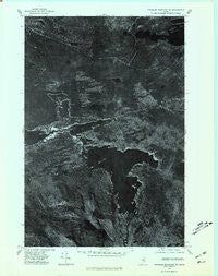
~ Traveler Mountain NE ME topo map, 1:24000 scale, 7.5 X 7.5 Minute, Historical, 1975, updated 1981
Traveler Mountain NE, Maine, USGS topographic map dated 1975.
Includes geographic coordinates (latitude and longitude). This topographic map is suitable for hiking, camping, and exploring, or framing it as a wall map.
Printed on-demand using high resolution imagery, on heavy weight and acid free paper, or alternatively on a variety of synthetic materials.
Topos available on paper, Waterproof, Poly, or Tyvek. Usually shipping rolled, unless combined with other folded maps in one order.
- Product Number: USGS-5535535
- Free digital map download (high-resolution, GeoPDF): Traveler Mountain NE, Maine (file size: 12 MB)
- Map Size: please refer to the dimensions of the GeoPDF map above
- Weight (paper map): ca. 55 grams
- Map Type: POD USGS Topographic Map
- Map Series: HTMC
- Map Verison: Historical
- Cell ID: 45737
- Scan ID: 807236
- Imprint Year: 1981
- Aerial Photo Year: 1975
- Datum: NAD27
- Map Projection: Transverse Mercator
- Orthophoto: Quad
- Map published by United States Geological Survey
- Keywords: Nonstandard Press Run
- Map Language: English
- Scanner Resolution: 508 dpi
- Map Cell Name: Trout Brook Mountain
- Grid size: 7.5 X 7.5 Minute
- Date on map: 1975
- Map Scale: 1:24000
- Geographical region: Maine, United States
Neighboring Maps:
All neighboring USGS topo maps are available for sale online at a variety of scales.
Spatial coverage:
Topo map Traveler Mountain NE, Maine, covers the geographical area associated the following places:
- Morrell Pond - Saddle Pond - Long Pond - Second Lake - Norway Dam - High Pond - Birch Point - Hay Brook - Boody Brook - Hub Hall Cove - Grand Lake Dam - Horse Mountain - Mountain Catcher Pond - Trout Brook Farm - Grand Lake Matagamon - Deep Cove - Round Pond - Little Mountain Catcher Pond - Lower Fowler Pond - Trout Brook - Louse Island - Billfish Brook - Billfish Pond - Littlefield Pond - Trout Brook Mountain - T6 R8 WELS - Scraggly Lake - Littlefield Brook - Matagamon Wilderness Campground - Hay Brook Logan - First Lake - Big Logan - Hay Pond
- Map Area ID: AREA46.2546.125-68.875-68.75
- Northwest corner Lat/Long code: USGSNW46.25-68.875
- Northeast corner Lat/Long code: USGSNE46.25-68.75
- Southwest corner Lat/Long code: USGSSW46.125-68.875
- Southeast corner Lat/Long code: USGSSE46.125-68.75
- Northern map edge Latitude: 46.25
- Southern map edge Latitude: 46.125
- Western map edge Longitude: -68.875
- Eastern map edge Longitude: -68.75


