
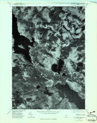
~ Richardson Pond ME topo map, 1:24000 scale, 7.5 X 7.5 Minute, Historical, 1977, updated 1983
Richardson Pond, Maine, USGS topographic map dated 1977.
Includes geographic coordinates (latitude and longitude). This topographic map is suitable for hiking, camping, and exploring, or framing it as a wall map.
Printed on-demand using high resolution imagery, on heavy weight and acid free paper, or alternatively on a variety of synthetic materials.
Topos available on paper, Waterproof, Poly, or Tyvek. Usually shipping rolled, unless combined with other folded maps in one order.
- Product Number: USGS-5535093
- Free digital map download (high-resolution, GeoPDF): Richardson Pond, Maine (file size: 11 MB)
- Map Size: please refer to the dimensions of the GeoPDF map above
- Weight (paper map): ca. 55 grams
- Map Type: POD USGS Topographic Map
- Map Series: HTMC
- Map Verison: Historical
- Cell ID: 37787
- Scan ID: 807097
- Imprint Year: 1983
- Aerial Photo Year: 1977
- Datum: NAD27
- Map Projection: Transverse Mercator
- Orthophoto: Quad
- Map published by United States Geological Survey
- Keywords: Nonstandard Press Run
- Map Language: English
- Scanner Resolution: 508 dpi
- Map Cell Name: Richardson Pond
- Grid size: 7.5 X 7.5 Minute
- Date on map: 1977
- Map Scale: 1:24000
- Geographical region: Maine, United States
Neighboring Maps:
All neighboring USGS topo maps are available for sale online at a variety of scales.
Spatial coverage:
Topo map Richardson Pond, Maine, covers the geographical area associated the following places:
- Beaver Pond - Mill Brook - Round Mountain - Sunday Pond (historical) - Observatory Mountain - Barney Brook - East Richardson Ponds - Big Beaver Island - Beaver Island - Black Brook Cove - Low Aziscohos Mountain - Aziscohos Pond - Fish Pond Brook - West Arm Upper Richardson Lake - Richardson Pond - Aziscohos Falls (historical) - Little Beaver Pond - Deer Mountain Stream - Beaver Brook - Pepperpot Pond - Adamstown Township - Plantation of Lincoln - Unorganized Territory of North Oxford - Beaver Brook - Aziscohos Dam
- Map Area ID: AREA4544.875-71-70.875
- Northwest corner Lat/Long code: USGSNW45-71
- Northeast corner Lat/Long code: USGSNE45-70.875
- Southwest corner Lat/Long code: USGSSW44.875-71
- Southeast corner Lat/Long code: USGSSE44.875-70.875
- Northern map edge Latitude: 45
- Southern map edge Latitude: 44.875
- Western map edge Longitude: -71
- Eastern map edge Longitude: -70.875


