
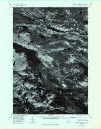
~ Rainbow Lake East ME topo map, 1:24000 scale, 7.5 X 7.5 Minute, Historical, 1978, updated 1981
Rainbow Lake East, Maine, USGS topographic map dated 1978.
Includes geographic coordinates (latitude and longitude). This topographic map is suitable for hiking, camping, and exploring, or framing it as a wall map.
Printed on-demand using high resolution imagery, on heavy weight and acid free paper, or alternatively on a variety of synthetic materials.
Topos available on paper, Waterproof, Poly, or Tyvek. Usually shipping rolled, unless combined with other folded maps in one order.
- Product Number: USGS-5535055
- Free digital map download (high-resolution, GeoPDF): Rainbow Lake East, Maine (file size: 10 MB)
- Map Size: please refer to the dimensions of the GeoPDF map above
- Weight (paper map): ca. 55 grams
- Map Type: POD USGS Topographic Map
- Map Series: HTMC
- Map Verison: Historical
- Cell ID: 36926
- Scan ID: 807085
- Imprint Year: 1981
- Aerial Photo Year: 1978
- Datum: NAD27
- Map Projection: Transverse Mercator
- Orthophoto: Quad
- Map published by United States Geological Survey
- Keywords: Nonstandard Press Run
- Map Language: English
- Scanner Resolution: 508 dpi
- Map Cell Name: Rainbow Lake East
- Grid size: 7.5 X 7.5 Minute
- Date on map: 1978
- Map Scale: 1:24000
- Geographical region: Maine, United States
Neighboring Maps:
All neighboring USGS topo maps are available for sale online at a variety of scales.
Spatial coverage:
Topo map Rainbow Lake East, Maine, covers the geographical area associated the following places:
- Horserace Brook - Nesowadnehunk Deadwater - Pitman Pond - Third Debsconeag Lake - Lost Pond - Nesowadnehunk Falls - Fifth Debsconeag Lake - Third Debsconeag Lake Dam - Big Ambejackmockamus Falls - Big Minister Pond - Horserace - Stratton Pond - Nesowadnehunk Stream - Indian Pitch Ponds - Sewall Pond - Little Niagara Falls - Moose Pond - Sentinel Mountain - Rainbow Lake - Little Minister Pond - Daisey Pond - Doughnut Pond - Windy Pitch - Toll Dam - Horserace Ponds - T2 R10 WELS - Trail Brook - Big Niagara Falls - Stink Pond - Little Beaver Pond - Sixth Debsconeag Pond - Little Hurd Pond - Big Beaver Pond - Woodman Pond - Blue Trail - Indian Pitch - Rainbow Mountain - Foss and Knowlton Pond - Seventh Debsconeag Pond - Minister Cove - Little Ambejackmockamus Falls - Fourth Debsconeag Lake - Second Debsconeag Lake - Clifford Pond
- Map Area ID: AREA45.87545.75-69.125-69
- Northwest corner Lat/Long code: USGSNW45.875-69.125
- Northeast corner Lat/Long code: USGSNE45.875-69
- Southwest corner Lat/Long code: USGSSW45.75-69.125
- Southeast corner Lat/Long code: USGSSE45.75-69
- Northern map edge Latitude: 45.875
- Southern map edge Latitude: 45.75
- Western map edge Longitude: -69.125
- Eastern map edge Longitude: -69


