
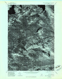
~ King And Bartlett Lake ME topo map, 1:24000 scale, 7.5 X 7.5 Minute, Historical, 1977, updated 1983
King And Bartlett Lake, Maine, USGS topographic map dated 1977.
Includes geographic coordinates (latitude and longitude). This topographic map is suitable for hiking, camping, and exploring, or framing it as a wall map.
Printed on-demand using high resolution imagery, on heavy weight and acid free paper, or alternatively on a variety of synthetic materials.
Topos available on paper, Waterproof, Poly, or Tyvek. Usually shipping rolled, unless combined with other folded maps in one order.
- Product Number: USGS-5534161
- Free digital map download (high-resolution, GeoPDF): King And Bartlett Lake, Maine (file size: 12 MB)
- Map Size: please refer to the dimensions of the GeoPDF map above
- Weight (paper map): ca. 55 grams
- Map Type: POD USGS Topographic Map
- Map Series: HTMC
- Map Verison: Historical
- Cell ID: 23583
- Scan ID: 806818
- Imprint Year: 1983
- Aerial Photo Year: 1977
- Datum: NAD27
- Map Projection: Transverse Mercator
- Orthophoto: Quad
- Map published by United States Geological Survey
- Keywords: Nonstandard Press Run
- Map Language: English
- Scanner Resolution: 508 dpi
- Map Cell Name: King And Bartlett Lake
- Grid size: 7.5 X 7.5 Minute
- Date on map: 1977
- Map Scale: 1:24000
- Geographical region: Maine, United States
Neighboring Maps:
All neighboring USGS topo maps are available for sale online at a variety of scales.
Spatial coverage:
Topo map King And Bartlett Lake, Maine, covers the geographical area associated the following places:
- Lower Shaw Pond - Horseshoe Pond - Joe Pokum Bog - Shaw Pond - King-Bartlett Lake Dam - Spencer Lake - Little King Ridge - Bear Mountain - Parker Bog Brook - King and Bartlett Lake - Parker Pond - Spencer Lake Dam - T3 R4 BKP WKR - Burnt Hill - Lost Pond - Spencer Gut - Cedar Pond - Parker Brook - Beck Pond - King and Bartlett Camps - Gore Rapids - Pray Hill - Black Nubble
- Map Area ID: AREA45.37545.25-70.375-70.25
- Northwest corner Lat/Long code: USGSNW45.375-70.375
- Northeast corner Lat/Long code: USGSNE45.375-70.25
- Southwest corner Lat/Long code: USGSSW45.25-70.375
- Southeast corner Lat/Long code: USGSSE45.25-70.25
- Northern map edge Latitude: 45.375
- Southern map edge Latitude: 45.25
- Western map edge Longitude: -70.375
- Eastern map edge Longitude: -70.25


