
~ Kind and Bartlett Mtn ME topo map, 1:24000 scale, 7.5 X 7.5 Minute, Historical, 1989, updated 1989
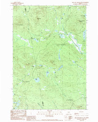
Kind and Bartlett Mtn , Maine, USGS topographic map dated 1989.
Includes geographic coordinates (latitude and longitude). This topographic map is suitable for hiking, camping, and exploring, or framing it as a wall map.
Printed on-demand using high resolution imagery, on heavy weight and acid free paper, or alternatively on a variety of synthetic materials.
Topos available on paper, Waterproof, Poly, or Tyvek. Usually shipping rolled, unless combined with other folded maps in one order.
- Product Number: USGS-5534159
- Free digital map download (high-resolution, GeoPDF): Kind and Bartlett Mtn , Maine (file size: 13 MB)
- Map Size: please refer to the dimensions of the GeoPDF map above
- Weight (paper map): ca. 55 grams
- Map Type: POD USGS Topographic Map
- Map Series: HTMC
- Map Verison: Historical
- Cell ID: 23584
- Scan ID: 105263
- Imprint Year: 1989
- Woodland Tint: Yes
- Aerial Photo Year: 1985
- Edit Year: 1988
- Field Check Year: 1987
- Datum: NAD27
- Map Projection: Transverse Mercator
- Provisional map: Yes
- Map published by United States Geological Survey
- Map Language: English
- Scanner Resolution: 600 dpi
- Map Cell Name: King And Bartlett Mountain
- Grid size: 7.5 X 7.5 Minute
- Date on map: 1989
- Map Scale: 1:24000
- Geographical region: Maine, United States
Neighboring Maps:
All neighboring USGS topo maps are available for sale online at a variety of scales.
Spatial coverage:
Topo map Kind and Bartlett Mtn , Maine, covers the geographical area associated the following places:
- Camera Hill - Spectacle Pond - Mud Pond - Joe Pokum Pond - Otter Pond - King and Bartlett Township - Long Pond - Hurricane Brook - Everett Pond - Spotted Spruce Mountain - Pickle Hill - Spencer Dam - Camera Ridge - Deer Pond - Farm Hill - Black Brook - Mud Pond - Chittenden Pond - The Chimes - Jim Pond Brook - Spencer Stream Dam - Whit Brook - Butler Pond - Little King Lake - Kibby Stream - Little Jim Pond - Kibby Kamp - Felker Pond - Lost Pond - King and Bartlett Mountain - Spencer Stream - Rush Pond
- Map Area ID: AREA45.37545.25-70.5-70.375
- Northwest corner Lat/Long code: USGSNW45.375-70.5
- Northeast corner Lat/Long code: USGSNE45.375-70.375
- Southwest corner Lat/Long code: USGSSW45.25-70.5
- Southeast corner Lat/Long code: USGSSE45.25-70.375
- Northern map edge Latitude: 45.375
- Southern map edge Latitude: 45.25
- Western map edge Longitude: -70.5
- Eastern map edge Longitude: -70.375


