
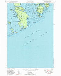
~ Great Wass Island ME topo map, 1:24000 scale, 7.5 X 7.5 Minute, Historical, 1950, updated 1983
Great Wass Island, Maine, USGS topographic map dated 1950.
Includes geographic coordinates (latitude and longitude). This topographic map is suitable for hiking, camping, and exploring, or framing it as a wall map.
Printed on-demand using high resolution imagery, on heavy weight and acid free paper, or alternatively on a variety of synthetic materials.
Topos available on paper, Waterproof, Poly, or Tyvek. Usually shipping rolled, unless combined with other folded maps in one order.
- Product Number: USGS-5533869
- Free digital map download (high-resolution, GeoPDF): Great Wass Island, Maine (file size: 21 MB)
- Map Size: please refer to the dimensions of the GeoPDF map above
- Weight (paper map): ca. 55 grams
- Map Type: POD USGS Topographic Map
- Map Series: HTMC
- Map Verison: Historical
- Cell ID: 18298
- Scan ID: 105171
- Imprint Year: 1983
- Woodland Tint: Yes
- Photo Inspection Year: 1975
- Aerial Photo Year: 1944
- Field Check Year: 1948
- Datum: NAD27
- Map Projection: Polyconic
- Map published by United States Department of Commerce
- Map Language: English
- Scanner Resolution: 600 dpi
- Map Cell Name: Great Wass Island
- Grid size: 7.5 X 7.5 Minute
- Date on map: 1950
- Map Scale: 1:24000
- Geographical region: Maine, United States
Neighboring Maps:
All neighboring USGS topo maps are available for sale online at a variety of scales.
Spatial coverage:
Topo map Great Wass Island, Maine, covers the geographical area associated the following places:
- Freeman Rock - Little Pond Head - Mud Hole Point - Norton Ledge - Mud Hole Channel - Slate Island - Little Cape Point - Crow Island - Mash Island - Steele Harbor Island - Norton Point - Upper Herring Cove - Fisherman Island - Lower Herring Cove - Great Wass Island Preserve - Eastern Bay - Crow Point - Hall Island - Black Ledges - Head Harbor - Great Wass Island - The Pond - Cape Cove - Hall Cove - Seal Rock - Red Head - Mink Island - Mannings Farm - Browney Island - Channel Rock - Mud Hole - Water Island - Three Falls Point - Green Rock - Brim Cove - Slate Island Cove - Moose Peak Light - Pond Point - Sand Cove North - Town of Beals - Mistake Island - Mistake Harbor - Knight Island - Man Island - Deep Cove - Little Hardwood Island - Mud Hole Trail - Curlew Rock - Folkingham Cove - Three Falls Harbor - Calf Island - Sand Cove - Big Peabody Island - Green Island - Black Head - Main Channel Way - Crumple Island - Popplestone Cove - Alley Point - The Cows Yard - Black Island - Green Island - Money Island - Popplestone Ledge - Little Peabody Island - Black Duck Cove
- Map Area ID: AREA44.544.375-67.625-67.5
- Northwest corner Lat/Long code: USGSNW44.5-67.625
- Northeast corner Lat/Long code: USGSNE44.5-67.5
- Southwest corner Lat/Long code: USGSSW44.375-67.625
- Southeast corner Lat/Long code: USGSSE44.375-67.5
- Northern map edge Latitude: 44.5
- Southern map edge Latitude: 44.375
- Western map edge Longitude: -67.625
- Eastern map edge Longitude: -67.5


