
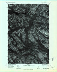
~ Eagle Lake SW ME topo map, 1:24000 scale, 7.5 X 7.5 Minute, Historical, 1975, updated 1981
Eagle Lake SW, Maine, USGS topographic map dated 1975.
Includes geographic coordinates (latitude and longitude). This topographic map is suitable for hiking, camping, and exploring, or framing it as a wall map.
Printed on-demand using high resolution imagery, on heavy weight and acid free paper, or alternatively on a variety of synthetic materials.
Topos available on paper, Waterproof, Poly, or Tyvek. Usually shipping rolled, unless combined with other folded maps in one order.
- Product Number: USGS-5533635
- Free digital map download (high-resolution, GeoPDF): Eagle Lake SW, Maine (file size: 13 MB)
- Map Size: please refer to the dimensions of the GeoPDF map above
- Weight (paper map): ca. 55 grams
- Map Type: POD USGS Topographic Map
- Map Series: HTMC
- Map Verison: Historical
- Cell ID: 47321
- Scan ID: 806661
- Imprint Year: 1981
- Aerial Photo Year: 1975
- Datum: NAD27
- Map Projection: Transverse Mercator
- Orthophoto: Quad
- Map published by United States Geological Survey
- Keywords: Nonstandard Press Run
- Map Language: English
- Scanner Resolution: 508 dpi
- Map Cell Name: Wallagrass Lakes
- Grid size: 7.5 X 7.5 Minute
- Date on map: 1975
- Map Scale: 1:24000
- Geographical region: Maine, United States
Neighboring Maps:
All neighboring USGS topo maps are available for sale online at a variety of scales.
Spatial coverage:
Topo map Eagle Lake SW, Maine, covers the geographical area associated the following places:
- Wallagrass Lakes - Labbe Camp - First Lake - Birch River Camp - Nichols Rapids - Cotes Camp - Dickwood Lake - Ox Bow - Saucier Camp - Second Lake - Quellette Brook - Mud Lake - Town of Eagle Lake - Deep Brook - Austins Dam - Black Brook - South Branch Birch River - Laliberte Camp - Gagnon Sugar Camp - Sauls Brook - Birch River Dam - Ben Lake - Godfrey Brook - North Branch Birch River - Marcial Lake - Isie Lake - Falls Camp - Fire Wardens Camp
- Map Area ID: AREA47.12547-68.75-68.625
- Northwest corner Lat/Long code: USGSNW47.125-68.75
- Northeast corner Lat/Long code: USGSNE47.125-68.625
- Southwest corner Lat/Long code: USGSSW47-68.75
- Southeast corner Lat/Long code: USGSSE47-68.625
- Northern map edge Latitude: 47.125
- Southern map edge Latitude: 47
- Western map edge Longitude: -68.75
- Eastern map edge Longitude: -68.625


