
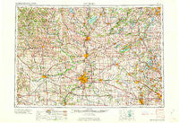
~ Rockford IL topo map, 1:250000 scale, 1 X 2 Degree, Historical, 1963, updated 1963
Rockford, Illinois, USGS topographic map dated 1963.
Includes geographic coordinates (latitude and longitude). This topographic map is suitable for hiking, camping, and exploring, or framing it as a wall map.
Printed on-demand using high resolution imagery, on heavy weight and acid free paper, or alternatively on a variety of synthetic materials.
Topos available on paper, Waterproof, Poly, or Tyvek. Usually shipping rolled, unless combined with other folded maps in one order.
- Product Number: USGS-5532959
- Free digital map download (high-resolution, GeoPDF): Rockford, Illinois (file size: 23 MB)
- Map Size: please refer to the dimensions of the GeoPDF map above
- Weight (paper map): ca. 55 grams
- Map Type: POD USGS Topographic Map
- Map Series: HTMC
- Map Verison: Historical
- Cell ID: 68990
- Scan ID: 310180
- Imprint Year: 1963
- Woodland Tint: Yes
- Aerial Photo Year: 1958
- Field Check Year: 1958
- Datum: Unstated
- Map Projection: Transverse Mercator
- Map published by United States Geological Survey
- Map published by United States Army Corps of Engineers
- Map published by United States Army
- Map Language: English
- Scanner Resolution: 600 dpi
- Map Cell Name: Rockford
- Grid size: 1 X 2 Degree
- Date on map: 1963
- Map Scale: 1:250000
- Geographical region: Illinois, United States
Neighboring Maps:
All neighboring USGS topo maps are available for sale online at a variety of scales.
Spatial coverage:
Topo map Rockford, Illinois, covers the geographical area associated the following places:
- Round Lake - Haegers Bend - Gilberts - Lake Zurich Heights - Blanchardville - Shopiere - Brentwood - Rockdale - Walworth - Barnard Mill (historical) - Mount Carroll - Belleville - Caledonia - McConnell - Hidden Hill - Algonquin - Busseyville - Thornfield - Westfield Corners - Lorimar Estates - Fairfield - Dayton - Twin Lakes Mobile Home Park - Moscow - Barreville - Deer Lake Meadows - Ottawa - Florence - Ridott Corners - Wildwood Valley - Plum Grove Village - River Forest - Lakewood Estates - Whitewater - Cardinal Crest - Prairie Grove - Oak Ridge - Springfield - Marengo - Harvard - Weldwood Oaks - Wilkinson - Winnebago - Byron Hills Estates - Woodcrest Heights - Lake Lawn - Mount Vernon - Hainesville - Myrtle - Samuelson Corners - Lauderdale - Pecatonica - Mylith Park - Kings Island - Kinseys Little Farms - Countryside West - Blackhawk Island - Grant Park - Hidden Valley - Morris Kennedy Subdivision - Klondike - Ski Hill - Shannon - Wauconda - Beiler Subdivision - Kings - German Valley - Sunrise Ridge - North Plato - Brooklyn - Cleveland Subdivision - Paynes Point - Emerald Park - Fitchburg - Stagecoach Hills - Harlem - Argyle - Loose Pulley Junction - Cary - Sturm Subdivision - Rockford - The Orchards - New Milford - Ashdale Junction - Darien - The Landings - Creekside - Woodford - Island Lake - Big Bend - Kildeer - Lilymoor - Lake Catherine - Lamont - North Prairie - Salem Oaks - Carpentersville - Lena - Loves Park - Crystal Lake
- Map Area ID: AREA4342-90-88
- Northwest corner Lat/Long code: USGSNW43-90
- Northeast corner Lat/Long code: USGSNE43-88
- Southwest corner Lat/Long code: USGSSW42-90
- Southeast corner Lat/Long code: USGSSE42-88
- Northern map edge Latitude: 43
- Southern map edge Latitude: 42
- Western map edge Longitude: -90
- Eastern map edge Longitude: -88


