
~ Decatur IL topo map, 1:250000 scale, 1 X 2 Degree, Historical, 1961, updated 1961
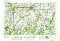
Decatur, Illinois, USGS topographic map dated 1961.
Includes geographic coordinates (latitude and longitude). This topographic map is suitable for hiking, camping, and exploring, or framing it as a wall map.
Printed on-demand using high resolution imagery, on heavy weight and acid free paper, or alternatively on a variety of synthetic materials.
Topos available on paper, Waterproof, Poly, or Tyvek. Usually shipping rolled, unless combined with other folded maps in one order.
- Product Number: USGS-5532933
- Free digital map download (high-resolution, GeoPDF): Decatur, Illinois (file size: 20 MB)
- Map Size: please refer to the dimensions of the GeoPDF map above
- Weight (paper map): ca. 55 grams
- Map Type: POD USGS Topographic Map
- Map Series: HTMC
- Map Verison: Historical
- Cell ID: 68743
- Scan ID: 310164
- Imprint Year: 1961
- Woodland Tint: Yes
- Field Check Year: 1958
- Datum: Unstated
- Map Projection: Transverse Mercator
- Map published by United States Geological Survey
- Map published by United States Army Corps of Engineers
- Map published by United States Army
- Map Language: English
- Scanner Resolution: 600 dpi
- Map Cell Name: Decatur
- Grid size: 1 X 2 Degree
- Date on map: 1961
- Map Scale: 1:250000
- Geographical region: Illinois, United States
Neighboring Maps:
All neighboring USGS topo maps are available for sale online at a variety of scales.
Spatial coverage:
Topo map Decatur, Illinois, covers the geographical area associated the following places:
- Chipps - Wenonah - West Ridge - Union Center - Farmingdale - Howards Point (historical) - Huffaker - Lillyville - Parkview - Compro - Tovey - Hindsboro - Panama - North Wind - Charleston - Millville - Baylestown - Ashmore - New Salem (historical) - Taylor Springs - Southmore Heights - LaPlace - Coles - Warrensburg - Sadorus - Shale Bluff - Mode - Keptown - Sexson Corner - Irving - Greenup - Big Oak Mobile Home Park - Gila - Faries Park (historical) - Maple Point - Old State Mobile Home Village - Bando - Nokomis - Hugo - Hunt City - Trilla - Lerna - Cerro Gordo - Newby - Leland Grove - Timothy - White City - Sherman - Shelbyville - South Strasburg - Brookville - Sigel - Hillcrest - Narita - Latham - Raymond - Bourbon - Plainview - Appalokia (historical) - Honey Bend - Pasfield - Voorhies - Sharpsburg - Mount Fulcher - Rardin - Humboldt - Browns Crossing - Moweaqua - Southland Acres - Galton - Barclay - Clarksdale - Lewisburg - Wrights Corner - Freenanton (historical) - Dressor - Greenridge - Magnet - East Gillespie - Larkdale - Tallula - New City - Walshville - Shumway - Riddle Hill - Dees - Pawnee Junction - White Oak - Bissell - Fancher - Ramsey - Peabody - Arcola - Osbernville - Herrick - Wilsonville - Camargo - Vera - Cornland - Hill Top
- Map Area ID: AREA4039-90-88
- Northwest corner Lat/Long code: USGSNW40-90
- Northeast corner Lat/Long code: USGSNE40-88
- Southwest corner Lat/Long code: USGSSW39-90
- Southeast corner Lat/Long code: USGSSE39-88
- Northern map edge Latitude: 40
- Southern map edge Latitude: 39
- Western map edge Longitude: -90
- Eastern map edge Longitude: -88


