
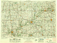
~ Danville IL topo map, 1:250000 scale, 1 X 2 Degree, Historical, 1956, updated 1956
Danville, Illinois, USGS topographic map dated 1956.
Includes geographic coordinates (latitude and longitude). This topographic map is suitable for hiking, camping, and exploring, or framing it as a wall map.
Printed on-demand using high resolution imagery, on heavy weight and acid free paper, or alternatively on a variety of synthetic materials.
Topos available on paper, Waterproof, Poly, or Tyvek. Usually shipping rolled, unless combined with other folded maps in one order.
- Product Number: USGS-5532923
- Free digital map download (high-resolution, GeoPDF): Danville, Illinois (file size: 18 MB)
- Map Size: please refer to the dimensions of the GeoPDF map above
- Weight (paper map): ca. 55 grams
- Map Type: POD USGS Topographic Map
- Map Series: HTMC
- Map Verison: Historical
- Cell ID: 68739
- Scan ID: 310160
- Imprint Year: 1956
- Woodland Tint: Yes
- Aerial Photo Year: 1952
- Field Check Year: 1953
- Datum: Unstated
- Map Projection: Transverse Mercator
- Map published by United States Geological Survey
- Map published by United States Army Corps of Engineers
- Map published by United States Army
- Map Language: English
- Scanner Resolution: 600 dpi
- Map Cell Name: Danville
- Grid size: 1 X 2 Degree
- Date on map: 1956
- Map Scale: 1:250000
- Geographical region: Illinois, United States
Neighboring Maps:
All neighboring USGS topo maps are available for sale online at a variety of scales.
Spatial coverage:
Topo map Danville, Illinois, covers the geographical area associated the following places:
- Cairo - New Waverly - Doyle - Danforth - Raub - Brookston - Thorntown - Marshtown - East Lynn - Martinton - Ellis - Courter - Crumb Corner - South Peru - Rayville - Beaverville - Shannondale - Burrows - Eagletown - Stringtown - Lincoln - Romney - Elston - Terhune - Reynolds - Hazel College - Fulton - Surrey - Yountsville - Vandercook - Manson - Little Charlie - Wellington - Watseka - Logansport - Bar-Barry Heights - Beckville - Cherry Grove - Russiaville - Goldsmith - Pickard - Owasco - West Lafayette - Concord - Mattix Corner - Octagon - Lochiel - Fountain - Chase - Sheridan - Harley - Yeoman - Foster - Pleasant View (historical) - Ridgeview - Missionfield - Onward - Bennetts Switch - Darlington - Norma Jean Addition - Crawfordsville - Rankin - Hamilton Estates Mobile Home Park - West Newell - Lockport - Hillery - Lakeside - Summit - Banning Corner - Deedsville - Westville - Shambaugh Siding - Old Adamsboro - Cassville - Pitchin - Anoka - Wyandot - Northfield - Barlow Park - Brendan Wood - Pellville - Collegeville - Tipton - Cambria - Winthrop - Swanington - Myersville (historical) - Prince William - Independence - Wagoner (historical) - Atlanta - Maysville Crossing - Himrod - Fountain Park - Pine Village - State Road - Rainsville - Mellott - Flora - East Monticello
- Map Area ID: AREA4140-88-86
- Northwest corner Lat/Long code: USGSNW41-88
- Northeast corner Lat/Long code: USGSNE41-86
- Southwest corner Lat/Long code: USGSSW40-88
- Southeast corner Lat/Long code: USGSSE40-86
- Northern map edge Latitude: 41
- Southern map edge Latitude: 40
- Western map edge Longitude: -88
- Eastern map edge Longitude: -86


