
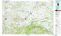
~ West Frankfort IL topo map, 1:100000 scale, 30 X 60 Minute, Historical, 1987, updated 1987
West Frankfort, Illinois, USGS topographic map dated 1987.
Includes geographic coordinates (latitude and longitude). This topographic map is suitable for hiking, camping, and exploring, or framing it as a wall map.
Printed on-demand using high resolution imagery, on heavy weight and acid free paper, or alternatively on a variety of synthetic materials.
Topos available on paper, Waterproof, Poly, or Tyvek. Usually shipping rolled, unless combined with other folded maps in one order.
- Product Number: USGS-5532893
- Free digital map download (high-resolution, GeoPDF): West Frankfort, Illinois (file size: 32 MB)
- Map Size: please refer to the dimensions of the GeoPDF map above
- Weight (paper map): ca. 55 grams
- Map Type: POD USGS Topographic Map
- Map Series: HTMC
- Map Verison: Historical
- Cell ID: 68570
- Scan ID: 310142
- Imprint Year: 1987
- Woodland Tint: Yes
- Aerial Photo Year: 1984
- Edit Year: 1987
- Datum: NAD27
- Map Projection: Universal Transverse Mercator
- Map published by United States Geological Survey
- Map Language: English
- Scanner Resolution: 600 dpi
- Map Cell Name: West Frankfort
- Grid size: 30 X 60 Minute
- Date on map: 1987
- Map Scale: 1:100000
- Geographical region: Illinois, United States
Neighboring Maps:
All neighboring USGS topo maps are available for sale online at a variety of scales.
Spatial coverage:
Topo map West Frankfort, Illinois, covers the geographical area associated the following places:
- Cambon - Beulah Heights - The Rocks - Tuckers Corners - Curlew - Dykersburg - Rock Creek - Halltown (historical) - New Hope - New Haven - Kedron - Fergestown - Egypt Shores - Inman - Parker - Spring Grove - Marion - Groat - Elba - Broughton - Dale - Watkins Ford - Omar - Cornerville - Equality - Egyptian Acres - Neilson - Sulphur Springs (historical) - Corinth - Greenville (historical) - Muddy - Pankeyville - Dog Walk - Galatia - Rural Hill - Shakerag - Parrish - Frankfort - Lawler - Middlepoint - Orient - Rectorville (historical) - Abbot - Delwood - Reyburn (historical) - Creal Springs - Garden Heights - Harrisburg - Bowlesville (historical) - Stonefort - Spillertown - Rodgersville - Norris City - Gaskins City - Sleepy Hollow - Dekoven - Old Shawneetown - Deering City - New Dennison - Red Bud (historical) - Deer Ridge - Benton - Long Branch - Ferber - Finneyville - West Rural Hill - Oak - Eldorado - New Burnside - Tison - Crestwood - Saline Valley Store (historical) - Henshaw - Chamness (historical) - Paulton - Texas City - Sugar Creek Ranch - Pittsburg - Fopal - Ozark - Somerset - Gross - Willeford - Mulfordtown - Herald - Dorrisville - Herod - Kelleys - Saline City - Bainbridge - Cedar Hills - Johnston City - Williams Trailer Court - Hudgens - Mitchellsville - Sandburn - Delta - McCormick - Wasson - Ridgway
- Map Area ID: AREA3837.5-89-88
- Northwest corner Lat/Long code: USGSNW38-89
- Northeast corner Lat/Long code: USGSNE38-88
- Southwest corner Lat/Long code: USGSSW37.5-89
- Southeast corner Lat/Long code: USGSSE37.5-88
- Northern map edge Latitude: 38
- Southern map edge Latitude: 37.5
- Western map edge Longitude: -89
- Eastern map edge Longitude: -88


