
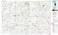
~ Watseka IL topo map, 1:100000 scale, 30 X 60 Minute, Historical, 1990, updated 1991
Watseka, Illinois, USGS topographic map dated 1990.
Includes geographic coordinates (latitude and longitude). This topographic map is suitable for hiking, camping, and exploring, or framing it as a wall map.
Printed on-demand using high resolution imagery, on heavy weight and acid free paper, or alternatively on a variety of synthetic materials.
Topos available on paper, Waterproof, Poly, or Tyvek. Usually shipping rolled, unless combined with other folded maps in one order.
- Product Number: USGS-5532889
- Free digital map download (high-resolution, GeoPDF): Watseka, Illinois (file size: 23 MB)
- Map Size: please refer to the dimensions of the GeoPDF map above
- Weight (paper map): ca. 55 grams
- Map Type: POD USGS Topographic Map
- Map Series: HTMC
- Map Verison: Historical
- Cell ID: 68555
- Scan ID: 310140
- Imprint Year: 1991
- Woodland Tint: Yes
- Aerial Photo Year: 1988
- Edit Year: 1990
- Datum: NAD27
- Map Projection: Universal Transverse Mercator
- Map published by United States Geological Survey
- Map Language: English
- Scanner Resolution: 600 dpi
- Map Cell Name: Watseka
- Grid size: 30 X 60 Minute
- Date on map: 1990
- Map Scale: 1:100000
- Geographical region: Illinois, United States
Neighboring Maps:
All neighboring USGS topo maps are available for sale online at a variety of scales.
Spatial coverage:
Topo map Watseka, Illinois, covers the geographical area associated the following places:
- Round Grove - Fowler - Webster - Milford - Donovan - Moody - Ashkum - Freeland Park - Fountain Creek - Gilman - Perkins - L'Erable - Coaler - Dunnington - Lochiel - Free - Oxford - Foresman - Atkinson - Newton - Pittwood - Papineau - McCoysburg - Barce - Claytonville - Martinton - Wolcott - Eastburn - Remington - Raub - Woodland Junction - Hickman - Sheff - Boswell - Collegeville - Hallock - Cutmer - South Marion - Chase - Yeagers Curve - Freedville - North Hooper - Effner - Darrow - Crescent City - Danforth - Sheldon - Greer - Beaverville - Hooper - Cissna Park - Talbot - Gravel Hill - Goodwine - Beaver City - Effner - Earl Park - Ade - Watseka - Woodworth - Dunn - Clifton - Rensselaer - Wadena - Templeton - Handy - Wellington - Fargo - Mount Ayr - Percy Junction - Surrey - Goodland - Woodland - Swanington - Iroquois - Bryce - Morocco - Leonard - Stockland - Egypt - Pleasant Ridge - Pitchin - Kentland - Brook - Schwer - North Marion - Fountain Park - Alonzo
- Map Area ID: AREA4140.5-88-87
- Northwest corner Lat/Long code: USGSNW41-88
- Northeast corner Lat/Long code: USGSNE41-87
- Southwest corner Lat/Long code: USGSSW40.5-88
- Southeast corner Lat/Long code: USGSSE40.5-87
- Northern map edge Latitude: 41
- Southern map edge Latitude: 40.5
- Western map edge Longitude: -88
- Eastern map edge Longitude: -87


