
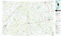
~ Olney IL topo map, 1:100000 scale, 30 X 60 Minute, Historical, 1986, updated 1986
Olney, Illinois, USGS topographic map dated 1986.
Includes geographic coordinates (latitude and longitude). This topographic map is suitable for hiking, camping, and exploring, or framing it as a wall map.
Printed on-demand using high resolution imagery, on heavy weight and acid free paper, or alternatively on a variety of synthetic materials.
Topos available on paper, Waterproof, Poly, or Tyvek. Usually shipping rolled, unless combined with other folded maps in one order.
- Product Number: USGS-5532861
- Free digital map download (high-resolution, GeoPDF): Olney, Illinois (file size: 20 MB)
- Map Size: please refer to the dimensions of the GeoPDF map above
- Weight (paper map): ca. 55 grams
- Map Type: POD USGS Topographic Map
- Map Series: HTMC
- Map Verison: Historical
- Cell ID: 68089
- Scan ID: 310126
- Imprint Year: 1986
- Woodland Tint: Yes
- Aerial Photo Year: 1981
- Edit Year: 1986
- Datum: NAD27
- Map Projection: Universal Transverse Mercator
- Planimetric: Yes
- Map published by United States Geological Survey
- Map Language: English
- Scanner Resolution: 600 dpi
- Map Cell Name: Olney
- Grid size: 30 X 60 Minute
- Date on map: 1986
- Map Scale: 1:100000
- Geographical region: Illinois, United States
Neighboring Maps:
All neighboring USGS topo maps are available for sale online at a variety of scales.
Spatial coverage:
Topo map Olney, Illinois, covers the geographical area associated the following places:
- Glenwood (historical) - Brownstown - Parkersburg - Cruse - Camp Travis - Rinard - Watertown (historical) - Farina - Hill - Clay City - Johnsonville - Newton - Sailor Springs - Kinmundy - Iuka - Noble - Passport - Ingraham - Lester - Willow Hill - Selmaville - Cisne - Bannister - Wilsonburg (historical) - Blue Point - Maysville - Hoosier - Riffle - Boos - Xenia - Enterprise - Kenner - Flora - La Clede - Olney - Omega - Gallagher - Loogootee - Brubaker - Bristol (historical) - Latona - Marion - Union Town - Saint James - Mount Erie - Bennington - Winterrowd - Schnell - Shamrock - Iola - Saint Peter - Gilmore - Bogota - Confidence - Bethel (historical) - Wilberton - Bible Grove - West Liberty - Alma - Maple Grove - Pureton - Zenith - Oskaloosa - Cartter - Eberle - Helm - Sainte Marie - Fransonia (historical) - Seminary - Raeftown - Orchardville - Greendale - Wakefield - Mason - Salem - Hord - Louisville - Wendelin - Dundas - Flemingsburg (historical) - West Salem - Calhoun - Elbow - Tonti - Edgewood - Wynoose - Foxville - Saint Paul
- Map Area ID: AREA3938.5-89-88
- Northwest corner Lat/Long code: USGSNW39-89
- Northeast corner Lat/Long code: USGSNE39-88
- Southwest corner Lat/Long code: USGSSW38.5-89
- Southeast corner Lat/Long code: USGSSE38.5-88
- Northern map edge Latitude: 39
- Southern map edge Latitude: 38.5
- Western map edge Longitude: -89
- Eastern map edge Longitude: -88


