
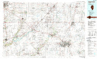
~ Champaign IL topo map, 1:100000 scale, 30 X 60 Minute, Historical, 1985, updated 1989
Champaign, Illinois, USGS topographic map dated 1985.
Includes geographic coordinates (latitude and longitude). This topographic map is suitable for hiking, camping, and exploring, or framing it as a wall map.
Printed on-demand using high resolution imagery, on heavy weight and acid free paper, or alternatively on a variety of synthetic materials.
Topos available on paper, Waterproof, Poly, or Tyvek. Usually shipping rolled, unless combined with other folded maps in one order.
- Product Number: USGS-5532815
- Free digital map download (high-resolution, GeoPDF): Champaign, Illinois (file size: 25 MB)
- Map Size: please refer to the dimensions of the GeoPDF map above
- Weight (paper map): ca. 55 grams
- Map Type: POD USGS Topographic Map
- Map Series: HTMC
- Map Verison: Historical
- Cell ID: 67266
- Scan ID: 310101
- Imprint Year: 1989
- Woodland Tint: Yes
- Edit Year: 1985
- Datum: NAD27
- Map Projection: Universal Transverse Mercator
- Map published by United States Geological Survey
- Map Language: English
- Scanner Resolution: 600 dpi
- Map Cell Name: Champaign
- Grid size: 30 X 60 Minute
- Date on map: 1985
- Map Scale: 1:100000
- Geographical region: Illinois, United States
Neighboring Maps:
All neighboring USGS topo maps are available for sale online at a variety of scales.
Spatial coverage:
Topo map Champaign, Illinois, covers the geographical area associated the following places:
- Sabina - Bentown - Brokaw - Prospect - Paxton - Empire - Philo - Dickerson - Saint Joseph - Southgate Estates Trailer Park - Shamrock - Colonial Meadows - Lane - Hilltop Trailer Park - Augerville - Seymour - Clinton - Ospur - Ellsworth - Ludlow - Sidney - Cisco - De Land - Proctor - Perdueville - Derby - Weldon - Rutherford - Gillum - Glover - Farmer City - Wapella - Champaign - Harris - White Heath - Padua - Galesville - Mansfield - Fullerton - Hendrix - Deers - Mahomet - Tipton - Savoy - Lodge - Urbana - Laurette - Harpster - McNulta - Centerville - Parnell - Downs - Flatville - Dewey - Mira - Littleville (historical) - Gibson City - Randolph - Blue Ridge - Gifford - Sellers - Rising - Maroa - Birkbeck - Bucks - Kenwood - Arrowsmith - Thomasboro - Weedman - De Witt - Troster - Rantoul - Dillsburg - Bellflower - Fulls - Monticello - Pauline - Carle Springs - Foosland - Le Roy - Staley - Heyworth - Tomlinson - Giblin - Bondville - Solomon - Kumler - Fisher - Watkins - Saybrook - Mayview - Osman - Amenia - Lotus - Burns - Combs - Bloomington - Elliott - Leverett - Lake of the Woods
- Map Area ID: AREA40.540-89-88
- Northwest corner Lat/Long code: USGSNW40.5-89
- Northeast corner Lat/Long code: USGSNE40.5-88
- Southwest corner Lat/Long code: USGSSW40-89
- Southeast corner Lat/Long code: USGSSE40-88
- Northern map edge Latitude: 40.5
- Southern map edge Latitude: 40
- Western map edge Longitude: -89
- Eastern map edge Longitude: -88


