
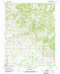
~ Paducah NE IL topo map, 1:24000 scale, 7.5 X 7.5 Minute, Historical, 1967, updated 1986
Paducah NE, Illinois, USGS topographic map dated 1967.
Includes geographic coordinates (latitude and longitude). This topographic map is suitable for hiking, camping, and exploring, or framing it as a wall map.
Printed on-demand using high resolution imagery, on heavy weight and acid free paper, or alternatively on a variety of synthetic materials.
Topos available on paper, Waterproof, Poly, or Tyvek. Usually shipping rolled, unless combined with other folded maps in one order.
- Product Number: USGS-5529693
- Free digital map download (high-resolution, GeoPDF): Paducah NE, Illinois (file size: 14 MB)
- Map Size: please refer to the dimensions of the GeoPDF map above
- Weight (paper map): ca. 55 grams
- Map Type: POD USGS Topographic Map
- Map Series: HTMC
- Map Verison: Historical
- Cell ID: 33885
- Scan ID: 308400
- Imprint Year: 1986
- Woodland Tint: Yes
- Aerial Photo Year: 1965
- Field Check Year: 1967
- Datum: NAD27
- Map Projection: Polyconic
- Map published by United States Geological Survey
- Map Language: English
- Scanner Resolution: 600 dpi
- Map Cell Name: Paducah NE
- Grid size: 7.5 X 7.5 Minute
- Date on map: 1967
- Map Scale: 1:24000
- Geographical region: Illinois, United States
Neighboring Maps:
All neighboring USGS topo maps are available for sale online at a variety of scales.
Spatial coverage:
Topo map Paducah NE, Illinois, covers the geographical area associated the following places:
- Azotus Cemetery - Hodge Cemetery - Roe Cemetery - Dean Cemetery - County Line School (historical) - Waldo Baptist Church - Bigley Cemetery - Good Hope School (historical) - Poco Cemetery - Mann Lake Dam - Klondike School (historical) - Masonic Cemetery - Pell Cemetery - Palmar School (historical) - Golightly Cemetery - Mount Pleasant Church - Mann Lake - Douglas Cemetery - Sycamore Plain Cemetery - Mount Sterling Church - East Brooklyn Election Precinct - Barrett Cemetery - Cretaceous Hills Nature Preserve - Avon Center Elementary School - McCormick Cemetery - Friendship School (historical) - Vickers Cemetery - Morrison Cemetery - Mill Spring - Upper Union School (historical) - Mallard Creek - Hohman Lake - Neely School (historical) - Brookport Cemetery - Fritts Cemetery - Independence School (historical) - Buzzard Roost Cemetery - Jefferson Number 4 Election Precinct - Unity Elementary School - Dean Cemetery
- Map Area ID: AREA37.2537.125-88.625-88.5
- Northwest corner Lat/Long code: USGSNW37.25-88.625
- Northeast corner Lat/Long code: USGSNE37.25-88.5
- Southwest corner Lat/Long code: USGSSW37.125-88.625
- Southeast corner Lat/Long code: USGSSE37.125-88.5
- Northern map edge Latitude: 37.25
- Southern map edge Latitude: 37.125
- Western map edge Longitude: -88.625
- Eastern map edge Longitude: -88.5


