
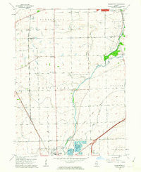
~ Normantown IL topo map, 1:24000 scale, 7.5 X 7.5 Minute, Historical, 1962, updated 1963
Normantown, Illinois, USGS topographic map dated 1962.
Includes geographic coordinates (latitude and longitude). This topographic map is suitable for hiking, camping, and exploring, or framing it as a wall map.
Printed on-demand using high resolution imagery, on heavy weight and acid free paper, or alternatively on a variety of synthetic materials.
Topos available on paper, Waterproof, Poly, or Tyvek. Usually shipping rolled, unless combined with other folded maps in one order.
- Product Number: USGS-5529543
- Free digital map download (high-resolution, GeoPDF): Normantown, Illinois (file size: 9 MB)
- Map Size: please refer to the dimensions of the GeoPDF map above
- Weight (paper map): ca. 55 grams
- Map Type: POD USGS Topographic Map
- Map Series: HTMC
- Map Verison: Historical
- Cell ID: 32288
- Scan ID: 308324
- Imprint Year: 1963
- Woodland Tint: Yes
- Aerial Photo Year: 1952
- Edit Year: 1962
- Survey Year: 1953
- Datum: NAD27
- Map Projection: Polyconic
- Map published by United States Geological Survey
- Map Language: English
- Scanner Resolution: 600 dpi
- Map Cell Name: Normantown
- Grid size: 7.5 X 7.5 Minute
- Date on map: 1962
- Map Scale: 1:24000
- Geographical region: Illinois, United States
Neighboring Maps:
All neighboring USGS topo maps are available for sale online at a variety of scales.
Spatial coverage:
Topo map Normantown, Illinois, covers the geographical area associated the following places:
- Graver Country Estates - Wheatland Highlands - Burnham Point - Prairie Ponds - Plantation - Plainfield - Pheasant Chase - River Woods - Wheatland View - Wolf Creek Island - Somerfield - Winchester Place - Southgate Park - Indian Chase Meadows - Shell Lake Estates - Frontenac - Brookwood Estates - River Oaks - Wolf Creek Estates - Old Sawmill - Hickory Oaks - Tuttle Farm - Foxridge Farms - Heritage Meadows - Walkers Grove - Clow Creek Farm - Golden Meadow Estates - Riverbend - Wheatland South - Normantown - Carillon - High Meadow - Prairie Knoll - Ponds of Plainfield - Lakewood Falls - Crossing - Champion Creek - River Edge Estates - Cider Creek - Heritage Knolls - Heritage Place - Woods of Rivermist - Crestview Knolls - Rivermist - Breckenridge Estates - Shenandoah - Quail Run - Country View Estates - Stillwater - Tamarack Fairways - Reserves at Clearwater - Bloomfield West - Kensington Club - Reserve of Plainfield - Indian Boundary - Rose Hill Farms - Brook Crossings Estates - Saddle Creek - Prairie Ridge - Rivercrest Estates - Woodlake - Harvest Glen - Heatherstone - Cambridge Place
- Map Area ID: AREA41.7541.625-88.25-88.125
- Northwest corner Lat/Long code: USGSNW41.75-88.25
- Northeast corner Lat/Long code: USGSNE41.75-88.125
- Southwest corner Lat/Long code: USGSSW41.625-88.25
- Southeast corner Lat/Long code: USGSSE41.625-88.125
- Northern map edge Latitude: 41.75
- Southern map edge Latitude: 41.625
- Western map edge Longitude: -88.25
- Eastern map edge Longitude: -88.125


