
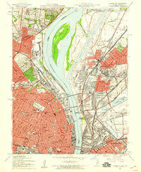
~ Granite City IL topo map, 1:24000 scale, 7.5 X 7.5 Minute, Historical, 1954, updated 1958
Granite City, Illinois, USGS topographic map dated 1954.
Includes geographic coordinates (latitude and longitude). This topographic map is suitable for hiking, camping, and exploring, or framing it as a wall map.
Printed on-demand using high resolution imagery, on heavy weight and acid free paper, or alternatively on a variety of synthetic materials.
Topos available on paper, Waterproof, Poly, or Tyvek. Usually shipping rolled, unless combined with other folded maps in one order.
- Product Number: USGS-5528353
- Free digital map download (high-resolution, GeoPDF): Granite City, Illinois (file size: 15 MB)
- Map Size: please refer to the dimensions of the GeoPDF map above
- Weight (paper map): ca. 55 grams
- Map Type: POD USGS Topographic Map
- Map Series: HTMC
- Map Verison: Historical
- Cell ID: 18060
- Scan ID: 307716
- Imprint Year: 1958
- Woodland Tint: Yes
- Aerial Photo Year: 1952
- Field Check Year: 1954
- Survey Year: 1933
- Datum: NAD27
- Map Projection: Polyconic
- Map published by United States Geological Survey
- Map published by United States Army
- Map Language: English
- Scanner Resolution: 600 dpi
- Map Cell Name: Granite City
- Grid size: 7.5 X 7.5 Minute
- Date on map: 1954
- Map Scale: 1:24000
- Geographical region: Illinois, United States
Neighboring Maps:
All neighboring USGS topo maps are available for sale online at a variety of scales.
Spatial coverage:
Topo map Granite City, Illinois, covers the geographical area associated the following places:
- Riverview - Hyde Park - Eagle Park - Madison - The Ville - Mark Twain - Greater Ville - Lacledes Landing - North Riverfront - Midtown - College Hill - Penrose - Brooklyn - Old North Saint Louis - Baden - North Venice - Venice - Nameoki - Prospect Hill - Walnut Park East - Saint Louis Place - Granite City - Covenant Blu-Grand Center - Jeff Vander Lou - Columbus Square - Bellefontaine Neighbors - Vandeventer - North Pointe - O'Fallon - Madison Station - Saint Louis - Newport - Near North Riverfront - National City - Carr Square - Moline Acres
- Map Area ID: AREA38.7538.625-90.25-90.125
- Northwest corner Lat/Long code: USGSNW38.75-90.25
- Northeast corner Lat/Long code: USGSNE38.75-90.125
- Southwest corner Lat/Long code: USGSSW38.625-90.25
- Southeast corner Lat/Long code: USGSSE38.625-90.125
- Northern map edge Latitude: 38.75
- Southern map edge Latitude: 38.625
- Western map edge Longitude: -90.25
- Eastern map edge Longitude: -90.125


