
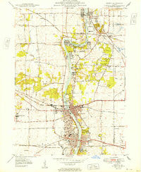
~ Geneva IL topo map, 1:24000 scale, 7.5 X 7.5 Minute, Historical, 1949
Geneva, Illinois, USGS topographic map dated 1949.
Includes geographic coordinates (latitude and longitude). This topographic map is suitable for hiking, camping, and exploring, or framing it as a wall map.
Printed on-demand using high resolution imagery, on heavy weight and acid free paper, or alternatively on a variety of synthetic materials.
Topos available on paper, Waterproof, Poly, or Tyvek. Usually shipping rolled, unless combined with other folded maps in one order.
- Product Number: USGS-5528257
- Free digital map download (high-resolution, GeoPDF): Geneva, Illinois (file size: 11 MB)
- Map Size: please refer to the dimensions of the GeoPDF map above
- Weight (paper map): ca. 55 grams
- Map Type: POD USGS Topographic Map
- Map Series: HTMC
- Map Verison: Historical
- Cell ID: 17037
- Scan ID: 307667
- Woodland Tint: Yes
- Aerial Photo Year: 1946
- Survey Year: 1948
- Datum: NAD27
- Map Projection: Polyconic
- Map published by United States Geological Survey
- Map Language: English
- Scanner Resolution: 600 dpi
- Map Cell Name: Geneva
- Grid size: 7.5 X 7.5 Minute
- Date on map: 1949
- Map Scale: 1:24000
- Geographical region: Illinois, United States
Neighboring Maps:
All neighboring USGS topo maps are available for sale online at a variety of scales.
Spatial coverage:
Topo map Geneva, Illinois, covers the geographical area associated the following places:
- Rainbow Hills - Saint Charles - Farmington - Bonnie Valley - Wildrose - Middlecreek - Coleman - Five Island Park - Mallard Lake South - Novak Park - Redgate Ridge - South Elgin - Pheasant Run - Wayne - River Grange Lakes - Evanswood - Crane Woods Estates - Wildrose Valley - Dunham Castle - Surrey Woods - Valley View - Fox River Estates - Crane Road Estates - Mallard Lake North - Ferson Creek Woods - Thornley - Youngsdale - Hawkins Glen - Fox River Heights - Knoll Creek West - Longview Estates - Lake Charlotte - Geneva - Bakers Acres
- Map Area ID: AREA4241.875-88.375-88.25
- Northwest corner Lat/Long code: USGSNW42-88.375
- Northeast corner Lat/Long code: USGSNE42-88.25
- Southwest corner Lat/Long code: USGSSW41.875-88.375
- Southeast corner Lat/Long code: USGSSE41.875-88.25
- Northern map edge Latitude: 42
- Southern map edge Latitude: 41.875
- Western map edge Longitude: -88.375
- Eastern map edge Longitude: -88.25


