
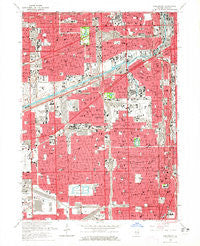
~ Englewood IL topo map, 1:24000 scale, 7.5 X 7.5 Minute, Historical, 1963, updated 1965
Englewood, Illinois, USGS topographic map dated 1963.
Includes geographic coordinates (latitude and longitude). This topographic map is suitable for hiking, camping, and exploring, or framing it as a wall map.
Printed on-demand using high resolution imagery, on heavy weight and acid free paper, or alternatively on a variety of synthetic materials.
Topos available on paper, Waterproof, Poly, or Tyvek. Usually shipping rolled, unless combined with other folded maps in one order.
- Product Number: USGS-5527999
- Free digital map download (high-resolution, GeoPDF): Englewood, Illinois (file size: 14 MB)
- Map Size: please refer to the dimensions of the GeoPDF map above
- Weight (paper map): ca. 55 grams
- Map Type: POD USGS Topographic Map
- Map Series: HTMC
- Map Verison: Historical
- Cell ID: 14389
- Scan ID: 307536
- Imprint Year: 1965
- Woodland Tint: Yes
- Aerial Photo Year: 1963
- Edit Year: 1963
- Survey Year: 1926
- Datum: NAD27
- Map Projection: Polyconic
- Map published by United States Geological Survey
- Map Language: English
- Scanner Resolution: 600 dpi
- Map Cell Name: Englewood
- Grid size: 7.5 X 7.5 Minute
- Date on map: 1963
- Map Scale: 1:24000
- Geographical region: Illinois, United States
Neighboring Maps:
All neighboring USGS topo maps are available for sale online at a variety of scales.
Spatial coverage:
Topo map Englewood, Illinois, covers the geographical area associated the following places:
- South Lawndale - Becks Park - North Lawndale - South Brighton - Englewood - Ducktown - Bronzeville - Locks - New City - Whiskey Row - McKinley Park - Mount Pleasant - Jane Addams Homes - Robert Brooks Homes - Lower West Side - Pilsen - West Englewood - Glendale - Sleepy Hollow - Whiskey Point - Fuller Park - Conleys Patch - Robert Taylor Homes (historical) - South Branch Addition - Mandell - New Patch - Archer Limits - Gage Park - Archer Heights - Corwith - Chinatown - Garfield Manor - LeClaire Courts - Claremont Cottages - South Lynn - Drexel Estate - Packingtown - Crawford - Back of the Yards - Marquette Manor - Dearborn Homes - Brighton Park - Chicago - Canaryville - Bridgeport - New Auburn - Mexico - Canalport - Grace Abbott Homes - West Lawn - Elsdon - West Elsdon - Armour Square - Armour Patch - Auburn Park - Forest Hill - Chicago Lawn - Bohemian California - Stateway Gardens (historical) - Garibaldi Square
- Map Area ID: AREA41.87541.75-87.75-87.625
- Northwest corner Lat/Long code: USGSNW41.875-87.75
- Northeast corner Lat/Long code: USGSNE41.875-87.625
- Southwest corner Lat/Long code: USGSSW41.75-87.75
- Southeast corner Lat/Long code: USGSSE41.75-87.625
- Northern map edge Latitude: 41.875
- Southern map edge Latitude: 41.75
- Western map edge Longitude: -87.75
- Eastern map edge Longitude: -87.625


