
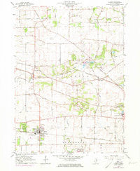
~ Elburn IL topo map, 1:24000 scale, 7.5 X 7.5 Minute, Historical, 1964, updated 1973
Elburn, Illinois, USGS topographic map dated 1964.
Includes geographic coordinates (latitude and longitude). This topographic map is suitable for hiking, camping, and exploring, or framing it as a wall map.
Printed on-demand using high resolution imagery, on heavy weight and acid free paper, or alternatively on a variety of synthetic materials.
Topos available on paper, Waterproof, Poly, or Tyvek. Usually shipping rolled, unless combined with other folded maps in one order.
- Product Number: USGS-5527901
- Free digital map download (high-resolution, GeoPDF): Elburn, Illinois (file size: 10 MB)
- Map Size: please refer to the dimensions of the GeoPDF map above
- Weight (paper map): ca. 55 grams
- Map Type: POD USGS Topographic Map
- Map Series: HTMC
- Map Verison: Historical
- Cell ID: 13858
- Scan ID: 307487
- Imprint Year: 1973
- Woodland Tint: Yes
- Photo Revision Year: 1972
- Aerial Photo Year: 1972
- Field Check Year: 1964
- Datum: NAD27
- Map Projection: Polyconic
- Map published by United States Geological Survey
- Map Language: English
- Scanner Resolution: 600 dpi
- Map Cell Name: Elburn
- Grid size: 7.5 X 7.5 Minute
- Date on map: 1964
- Map Scale: 1:24000
- Geographical region: Illinois, United States
Neighboring Maps:
All neighboring USGS topo maps are available for sale online at a variety of scales.
Spatial coverage:
Topo map Elburn, Illinois, covers the geographical area associated the following places:
- The Knolls - Lily Lake - High Point - Kings Mill - Silver Glen Meadows - Homeward Hill - Foxfield - Native Prairie - Still Meadows - Campton Hills - Empire Hills - Deer Run - Forest Hills - Oak Openings - Briar Gate - Wideview - Appaloosa West - Indian Creek - Split Rail Farm - Wasco - La Fox - Brookside - Plato Corners - Burning Tree - Hedgerow - Sunset Villa - Far View - Dillonfield - Hastings - Happy Hills - Mary Meadows - Campton Pines - Weybridge - Elburn - Fair Oaks
- Map Area ID: AREA4241.875-88.5-88.375
- Northwest corner Lat/Long code: USGSNW42-88.5
- Northeast corner Lat/Long code: USGSNE42-88.375
- Southwest corner Lat/Long code: USGSSW41.875-88.5
- Southeast corner Lat/Long code: USGSSE41.875-88.375
- Northern map edge Latitude: 42
- Southern map edge Latitude: 41.875
- Western map edge Longitude: -88.5
- Eastern map edge Longitude: -88.375


