
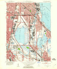
~ Calumet Lake IL topo map, 1:24000 scale, 7.5 X 7.5 Minute, Historical, 1953, updated 1955
Calumet Lake, Illinois, USGS topographic map dated 1953.
Includes geographic coordinates (latitude and longitude). This topographic map is suitable for hiking, camping, and exploring, or framing it as a wall map.
Printed on-demand using high resolution imagery, on heavy weight and acid free paper, or alternatively on a variety of synthetic materials.
Topos available on paper, Waterproof, Poly, or Tyvek. Usually shipping rolled, unless combined with other folded maps in one order.
- Product Number: USGS-5527319
- Free digital map download (high-resolution, GeoPDF): Calumet Lake, Illinois (file size: 17 MB)
- Map Size: please refer to the dimensions of the GeoPDF map above
- Weight (paper map): ca. 55 grams
- Map Type: POD USGS Topographic Map
- Map Series: HTMC
- Map Verison: Historical
- Cell ID: 24364
- Scan ID: 307187
- Imprint Year: 1955
- Woodland Tint: Yes
- Edit Year: 1953
- Survey Year: 1927
- Datum: NAD27
- Map Projection: Polyconic
- Map published by United States Geological Survey
- Map Language: English
- Scanner Resolution: 600 dpi
- Map Cell Name: Lake Calumet
- Grid size: 7.5 X 7.5 Minute
- Date on map: 1953
- Map Scale: 1:24000
- Geographical region: Illinois, United States
Neighboring Maps:
All neighboring USGS topo maps are available for sale online at a variety of scales.
Spatial coverage:
Topo map Calumet Lake, Illinois, covers the geographical area associated the following places:
- South Pole - Jeffery Manor - North Pullman - Pierces Park - Pullman - Trumbull Park Terrace - Riverdale - Robertsdale - Dolton - The Bush - Sheffield Estates - Chatham - Merrionette Manor - Ironworkers Addition to South Chicago - Avalon Highlands - Cheltenham - South Chicago - Honeymoon Row - Burnham - Philip Murray Homes - Irondale - Kensington - Burnside - The Cottage - Garden Homes - Altgeld Gardens - Stony Island - Taylors Addition to South Chicago - Irondale (historical) - South Deering - East Side - Chatham Fields - Burnside - South Chicago Heights - Hegewisch - Trumbull Park Homes - Calumet - Stony Island Heights - Arcade Row - Dauphin Park - Green Bay - Avalon Park - Calumet Heights
- Map Area ID: AREA41.7541.625-87.625-87.5
- Northwest corner Lat/Long code: USGSNW41.75-87.625
- Northeast corner Lat/Long code: USGSNE41.75-87.5
- Southwest corner Lat/Long code: USGSSW41.625-87.625
- Southeast corner Lat/Long code: USGSSE41.625-87.5
- Northern map edge Latitude: 41.75
- Southern map edge Latitude: 41.625
- Western map edge Longitude: -87.625
- Eastern map edge Longitude: -87.5


