
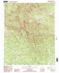
~ Wren Peak CA topo map, 1:24000 scale, 7.5 X 7.5 Minute, Historical, 1992, updated 1995
Wren Peak, California, USGS topographic map dated 1992.
Includes geographic coordinates (latitude and longitude). This topographic map is suitable for hiking, camping, and exploring, or framing it as a wall map.
Printed on-demand using high resolution imagery, on heavy weight and acid free paper, or alternatively on a variety of synthetic materials.
Topos available on paper, Waterproof, Poly, or Tyvek. Usually shipping rolled, unless combined with other folded maps in one order.
- Product Number: USGS-5526399
- Free digital map download (high-resolution, GeoPDF): Wren Peak, California (file size: 19 MB)
- Map Size: please refer to the dimensions of the GeoPDF map above
- Weight (paper map): ca. 55 grams
- Map Type: POD USGS Topographic Map
- Map Series: HTMC
- Map Verison: Historical
- Cell ID: 72110
- Scan ID: 102168
- Imprint Year: 1995
- Woodland Tint: Yes
- Visual Version Number: 1
- Photo Inspection Year: 1992
- Aerial Photo Year: 1983
- Datum: NAD27
- Map Projection: Lambert Conformal Conic
- Provisional map: Yes
- Map published by United States Geological Survey
- Map Language: English
- Scanner Resolution: 600 dpi
- Map Cell Name: Wren Peak
- Grid size: 7.5 X 7.5 Minute
- Date on map: 1992
- Map Scale: 1:24000
- Geographical region: California, United States
Neighboring Maps:
All neighboring USGS topo maps are available for sale online at a variety of scales.
Spatial coverage:
Topo map Wren Peak, California, covers the geographical area associated the following places:
- Wren Creek - Rattlesnake Creek - Little Boulder Creek - Brush Canyon - Horseshoe Bend Grove - Evans Creek - Wren Peak - Monarch Wilderness - Kennedy Meadow - Camp Seven - Lost Meadow - Landslide Grove - Boulder Creek - Buck Rock Creek - Yucca Point - Evans Grove - Deer Meadow - Redwood Creek - Windy Gulch - Tornado Meadow - Lockwood Creek - Eagle Spur - Deer Meadow Grove - Lockwood Grove - Windy Cliffs - Horseshoe Bend - Tombstone Creek - Burton Pass - Kennedy Grove - Burton Grove - Burton Meadow - Happy Gap - Agnew Grove - Junction Ridge - Footman Canyon - Windy Gulch Grove
- Map Area ID: AREA36.87536.75-118.875-118.75
- Northwest corner Lat/Long code: USGSNW36.875-118.875
- Northeast corner Lat/Long code: USGSNE36.875-118.75
- Southwest corner Lat/Long code: USGSSW36.75-118.875
- Southeast corner Lat/Long code: USGSSE36.75-118.75
- Northern map edge Latitude: 36.875
- Southern map edge Latitude: 36.75
- Western map edge Longitude: -118.875
- Eastern map edge Longitude: -118.75


