
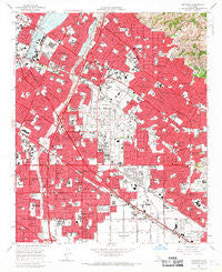
~ Whittier CA topo map, 1:24000 scale, 7.5 X 7.5 Minute, Historical, 1965, updated 1967
Whittier, California, USGS topographic map dated 1965.
Includes geographic coordinates (latitude and longitude). This topographic map is suitable for hiking, camping, and exploring, or framing it as a wall map.
Printed on-demand using high resolution imagery, on heavy weight and acid free paper, or alternatively on a variety of synthetic materials.
Topos available on paper, Waterproof, Poly, or Tyvek. Usually shipping rolled, unless combined with other folded maps in one order.
- Product Number: USGS-5526155
- Free digital map download (high-resolution, GeoPDF): Whittier, California (file size: 14 MB)
- Map Size: please refer to the dimensions of the GeoPDF map above
- Weight (paper map): ca. 55 grams
- Map Type: POD USGS Topographic Map
- Map Series: HTMC
- Map Verison: Historical
- Cell ID: 48930
- Scan ID: 301363
- Imprint Year: 1967
- Woodland Tint: Yes
- Aerial Photo Year: 1963
- Edit Year: 1949
- Survey Year: 1965
- Datum: NAD27
- Map Projection: Polyconic
- Map published by United States Geological Survey
- Map Language: English
- Scanner Resolution: 600 dpi
- Map Cell Name: Whittier
- Grid size: 7.5 X 7.5 Minute
- Date on map: 1965
- Map Scale: 1:24000
- Geographical region: California, United States
Neighboring Maps:
All neighboring USGS topo maps are available for sale online at a variety of scales.
Spatial coverage:
Topo map Whittier, California, covers the geographical area associated the following places:
- South Whittier - West Whittier - Valla - Downey Road - Los Nietos - Whittier - Bandini - Studebaker - Evergreen (historical) - East Whittier - Santa Fe Springs - Bellflower - Rio Hondo - Pico Rivera - Friendly Hills - Los Nietos Junction - La Mirada - McCampbell - Fulton Wells - Colima - Carmenita - Norwalk
- Map Area ID: AREA3433.875-118.125-118
- Northwest corner Lat/Long code: USGSNW34-118.125
- Northeast corner Lat/Long code: USGSNE34-118
- Southwest corner Lat/Long code: USGSSW33.875-118.125
- Southeast corner Lat/Long code: USGSSE33.875-118
- Northern map edge Latitude: 34
- Southern map edge Latitude: 33.875
- Western map edge Longitude: -118.125
- Eastern map edge Longitude: -118


