
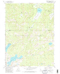
~ Webber Peak CA topo map, 1:24000 scale, 7.5 X 7.5 Minute, Historical, 1981, updated 1987
Webber Peak, California, USGS topographic map dated 1981.
Includes geographic coordinates (latitude and longitude). This topographic map is suitable for hiking, camping, and exploring, or framing it as a wall map.
Printed on-demand using high resolution imagery, on heavy weight and acid free paper, or alternatively on a variety of synthetic materials.
Topos available on paper, Waterproof, Poly, or Tyvek. Usually shipping rolled, unless combined with other folded maps in one order.
- Product Number: USGS-5525761
- Free digital map download (high-resolution, GeoPDF): Webber Peak, California (file size: 12 MB)
- Map Size: please refer to the dimensions of the GeoPDF map above
- Weight (paper map): ca. 55 grams
- Map Type: POD USGS Topographic Map
- Map Series: HTMC
- Map Verison: Historical
- Cell ID: 47897
- Scan ID: 295682
- Imprint Year: 1987
- Woodland Tint: Yes
- Visual Version Number: 1
- Aerial Photo Year: 1974
- Edit Year: 1981
- Field Check Year: 1975
- Datum: NAD27
- Map Projection: Lambert Conformal Conic
- Map published by United States Geological Survey
- Map Language: English
- Scanner Resolution: 600 dpi
- Map Cell Name: Webber Peak
- Grid size: 7.5 X 7.5 Minute
- Date on map: 1981
- Map Scale: 1:24000
- Geographical region: California, United States
Neighboring Maps:
All neighboring USGS topo maps are available for sale online at a variety of scales.
Spatial coverage:
Topo map Webber Peak, California, covers the geographical area associated the following places:
- Jones Valley - Fordyce Lake - North Creek - White Rock Lake - Webber Peak - Bull Flat - Bear Valley - French Meadow - Moscove Meadow - Sand Ridge Lake - Anderson Mine - White Rock Lake 97-049 Dam - Buzzard Roost Lake - Lacey Valley - Meadow Lake Hill - Burnt Flat - Meadow Lake 97-040 Dam - Paradise Valley - Webber Lake Campground - Lake Fordyce 97-028 Dam - White Rock Creek - Coppins Meadow - Webber Lake - Perazzo Canyon - Fordyce Lake Trail - Meadow Lake - Mossy Pond
- Map Area ID: AREA39.539.375-120.5-120.375
- Northwest corner Lat/Long code: USGSNW39.5-120.5
- Northeast corner Lat/Long code: USGSNE39.5-120.375
- Southwest corner Lat/Long code: USGSSW39.375-120.5
- Southeast corner Lat/Long code: USGSSE39.375-120.375
- Northern map edge Latitude: 39.5
- Southern map edge Latitude: 39.375
- Western map edge Longitude: -120.5
- Eastern map edge Longitude: -120.375


