
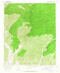
~ Warm Springs Mountain CA topo map, 1:24000 scale, 7.5 X 7.5 Minute, Historical, 1958, updated 1965
Warm Springs Mountain, California, USGS topographic map dated 1958.
Includes geographic coordinates (latitude and longitude). This topographic map is suitable for hiking, camping, and exploring, or framing it as a wall map.
Printed on-demand using high resolution imagery, on heavy weight and acid free paper, or alternatively on a variety of synthetic materials.
Topos available on paper, Waterproof, Poly, or Tyvek. Usually shipping rolled, unless combined with other folded maps in one order.
- Product Number: USGS-5525589
- Free digital map download (high-resolution, GeoPDF): Warm Springs Mountain, California (file size: 17 MB)
- Map Size: please refer to the dimensions of the GeoPDF map above
- Weight (paper map): ca. 55 grams
- Map Type: POD USGS Topographic Map
- Map Series: HTMC
- Map Verison: Historical
- Cell ID: 47485
- Scan ID: 301202
- Imprint Year: 1965
- Woodland Tint: Yes
- Aerial Photo Year: 1956
- Field Check Year: 1958
- Datum: NAD27
- Map Projection: Polyconic
- Map published by United States Geological Survey
- Map Language: English
- Scanner Resolution: 600 dpi
- Map Cell Name: Warm Springs Mountain
- Grid size: 7.5 X 7.5 Minute
- Date on map: 1958
- Map Scale: 1:24000
- Geographical region: California, United States
Neighboring Maps:
All neighboring USGS topo maps are available for sale online at a variety of scales.
Spatial coverage:
Topo map Warm Springs Mountain, California, covers the geographical area associated the following places:
- Castaic Lake State Recreation Area - Tule Target Shooting Area - United States Forest Service Angeles National Forest Station - San Francisquito Canyon - Castaic Tunnel Number One - Bee School (historical) - Castaic Lake - Ruby Canyon - Bitter Canyon - Warm Springs Divide Truck Trail - Tule Canyon - San Francisquito Powerhouse Number Two - Necktie Basin - Warm Springs Trail - Drinkwater Reservoir - Elizabeth Lake Canyon Campground - Newhall Division - Prospect Canyon - Ruby Spring - Dry Target Shooting Area - Los Angeles Aqueduct - Warm Springs Mountain - South Tule Canyon - Warm Springs Necktie Trail - Daries Ranch (historical) - Kleine Canyon - Drinkwater 6-016 Dam - Baal Point Picnic Area - Ruby Clearwater Truck Trail - Dry Gulch - Rattlesnake Canyon - Castaic Dam Heliport - Elizabeth Lake Guard Station - Warm Springs Fish Canyon Truck Trail - Warm Springs Camp - Red Mountain - Drinkwater Flat - Elizabeth Lake Canyon - Warm Springs Canyon - Necktie Canyon - Grasshopper Canyon - Canyon Christian Camp - Drinkwater Canyon - Castaic Valley Siphon - Castaic Lake Dam - Prospect Campground
- Map Area ID: AREA34.62534.5-118.625-118.5
- Northwest corner Lat/Long code: USGSNW34.625-118.625
- Northeast corner Lat/Long code: USGSNE34.625-118.5
- Southwest corner Lat/Long code: USGSSW34.5-118.625
- Southeast corner Lat/Long code: USGSSE34.5-118.5
- Northern map edge Latitude: 34.625
- Southern map edge Latitude: 34.5
- Western map edge Longitude: -118.625
- Eastern map edge Longitude: -118.5


