
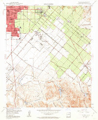
~ Tustin CA topo map, 1:24000 scale, 7.5 X 7.5 Minute, Historical, 1948, updated 1962
Tustin, California, USGS topographic map dated 1948.
Includes geographic coordinates (latitude and longitude). This topographic map is suitable for hiking, camping, and exploring, or framing it as a wall map.
Printed on-demand using high resolution imagery, on heavy weight and acid free paper, or alternatively on a variety of synthetic materials.
Topos available on paper, Waterproof, Poly, or Tyvek. Usually shipping rolled, unless combined with other folded maps in one order.
- Product Number: USGS-5525085
- Free digital map download (high-resolution, GeoPDF): Tustin, California (file size: 13 MB)
- Map Size: please refer to the dimensions of the GeoPDF map above
- Weight (paper map): ca. 55 grams
- Map Type: POD USGS Topographic Map
- Map Series: HTMC
- Map Verison: Historical
- Cell ID: 46043
- Scan ID: 301022
- Imprint Year: 1962
- Woodland Tint: Yes
- Aerial Photo Year: 1946
- Field Check Year: 1948
- Survey Year: 1932
- Datum: NAD27
- Map Projection: Polyconic
- Map published by United States Geological Survey
- Map Language: English
- Scanner Resolution: 600 dpi
- Map Cell Name: Tustin
- Grid size: 7.5 X 7.5 Minute
- Date on map: 1948
- Map Scale: 1:24000
- Geographical region: California, United States
Neighboring Maps:
All neighboring USGS topo maps are available for sale online at a variety of scales.
Spatial coverage:
Topo map Tustin, California, covers the geographical area associated the following places:
- The Meadows - Como - Browning - Saddleback Mobile Lodge - Frances - Aliso - East Irvine - South Santa Ana - Villa Valencia - Montesilla Mobile Home Club - Standard Avenue Mobile Home Park - Tustin Village Mobile Home Club - Parque Santiago Mobile Home Park - Rail-A-Way Trailer Park - Kathryn - Irvine - Villa Grande Mobile Home Park - Santa Ana - Dyer - Tustin - Myford
- Map Area ID: AREA33.7533.625-117.875-117.75
- Northwest corner Lat/Long code: USGSNW33.75-117.875
- Northeast corner Lat/Long code: USGSNE33.75-117.75
- Southwest corner Lat/Long code: USGSSW33.625-117.875
- Southeast corner Lat/Long code: USGSSE33.625-117.75
- Northern map edge Latitude: 33.75
- Southern map edge Latitude: 33.625
- Western map edge Longitude: -117.875
- Eastern map edge Longitude: -117.75


