
~ Triple Divide Peak CA topo map, 1:24000 scale, 7.5 X 7.5 Minute, Historical, 1988, updated 1988
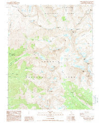
Triple Divide Peak, California, USGS topographic map dated 1988.
Includes geographic coordinates (latitude and longitude). This topographic map is suitable for hiking, camping, and exploring, or framing it as a wall map.
Printed on-demand using high resolution imagery, on heavy weight and acid free paper, or alternatively on a variety of synthetic materials.
Topos available on paper, Waterproof, Poly, or Tyvek. Usually shipping rolled, unless combined with other folded maps in one order.
- Product Number: USGS-5524887
- Free digital map download (high-resolution, GeoPDF): Triple Divide Peak, California (file size: 15 MB)
- Map Size: please refer to the dimensions of the GeoPDF map above
- Weight (paper map): ca. 55 grams
- Map Type: POD USGS Topographic Map
- Map Series: HTMC
- Map Verison: Historical
- Cell ID: 45704
- Scan ID: 295522
- Imprint Year: 1988
- Woodland Tint: Yes
- Aerial Photo Year: 1984
- Edit Year: 1988
- Field Check Year: 1985
- Datum: NAD27
- Map Projection: Lambert Conformal Conic
- Provisional map: Yes
- Map published by United States Geological Survey
- Map Language: English
- Scanner Resolution: 600 dpi
- Map Cell Name: Triple Divide Peak
- Grid size: 7.5 X 7.5 Minute
- Date on map: 1988
- Map Scale: 1:24000
- Geographical region: California, United States
Neighboring Maps:
All neighboring USGS topo maps are available for sale online at a variety of scales.
Spatial coverage:
Topo map Triple Divide Peak, California, covers the geographical area associated the following places:
- Glacier Lake - Eagle Scout Peak - Kaweah Queen - Sequoia National Park - Colby Pass - Kaweah Gap - Nine Lake Basin - Elizabeth Pass - Precipice Lake - Lippincott Mountain - Lion Rock - Hamilton Creek - Bearpaw Meadow High Sierra Camp - Red Kaweah - Copper Mine Pass - Lion Lake - Lone Pine Creek - Mount Stewart - Lilliput Glacier - Old Big Arroyo Patrol Cabin - Lawson Peak - Little Five Lakes - Hamilton Lakes - Lonely Lake - Kings-Kaweah Divide - Big Bird Lake - Triple Divide Pass - Bearpaw Meadow Ranger Station - Triple Divide Peak - Lone Pine Meadow - Black Kaweah - Bearpaw Meadow - High Sierra Trail - Valhalla - Tamarack Lake
- Map Area ID: AREA36.62536.5-118.625-118.5
- Northwest corner Lat/Long code: USGSNW36.625-118.625
- Northeast corner Lat/Long code: USGSNE36.625-118.5
- Southwest corner Lat/Long code: USGSSW36.5-118.625
- Southeast corner Lat/Long code: USGSSE36.5-118.5
- Northern map edge Latitude: 36.625
- Southern map edge Latitude: 36.5
- Western map edge Longitude: -118.625
- Eastern map edge Longitude: -118.5


