
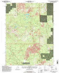
~ Thousand Lakes Valley CA topo map, 1:24000 scale, 7.5 X 7.5 Minute, Historical, 1995, updated 1997
Thousand Lakes Valley, California, USGS topographic map dated 1995.
Includes geographic coordinates (latitude and longitude). This topographic map is suitable for hiking, camping, and exploring, or framing it as a wall map.
Printed on-demand using high resolution imagery, on heavy weight and acid free paper, or alternatively on a variety of synthetic materials.
Topos available on paper, Waterproof, Poly, or Tyvek. Usually shipping rolled, unless combined with other folded maps in one order.
- Product Number: USGS-5524571
- Free digital map download (high-resolution, GeoPDF): Thousand Lakes Valley, California (file size: 16 MB)
- Map Size: please refer to the dimensions of the GeoPDF map above
- Weight (paper map): ca. 55 grams
- Map Type: POD USGS Topographic Map
- Map Series: HTMC
- Map Verison: Historical
- Cell ID: 44977
- Scan ID: 102017
- Imprint Year: 1997
- Woodland Tint: Yes
- Aerial Photo Year: 1993
- Field Check Year: 1995
- Datum: NAD27
- Map Projection: Lambert Conformal Conic
- Map published by United States Forest Service
- Map Language: English
- Scanner Resolution: 600 dpi
- Map Cell Name: Thousand Lakes Valley
- Grid size: 7.5 X 7.5 Minute
- Date on map: 1995
- Map Scale: 1:24000
- Geographical region: California, United States
Neighboring Maps:
All neighboring USGS topo maps are available for sale online at a variety of scales.
Spatial coverage:
Topo map Thousand Lakes Valley, California, covers the geographical area associated the following places:
- Mud Lake - Tamarack Swale - Bunchgrass Campground - Little Logan Butte - Bear Wallow Butte - Cornaz Spring - Barrett Lake - Durbin Lake - Hufford Lake - Box Lake - Bunchgrass Trail - Cypress Campground - Freaner Peak - Hall Butte - Everett Lake - Wilcox Trail - Crater Peak - Logan Mountain - Magee Lake - Red Cliff - Cypress Camp Trail - Bunchgrass Valley - Fredonyer Peak - Thousand Lakes Valley - Tumble Buttes - Lower Twin Lake - Logan Gulch - Lake Eiler - Cornez Spring - Eiler Butte - Gray Cliff - Magee Peak - Wilcox Spring - Bunchgrass Creek - Magee Lookout - Magee Trail - Thousand Lakes Wilderness - Upper Twin Lake - Tamarack Swale Trail - Devils Rock Garden
- Map Area ID: AREA40.7540.625-121.625-121.5
- Northwest corner Lat/Long code: USGSNW40.75-121.625
- Northeast corner Lat/Long code: USGSNE40.75-121.5
- Southwest corner Lat/Long code: USGSSW40.625-121.625
- Southeast corner Lat/Long code: USGSSE40.625-121.5
- Northern map edge Latitude: 40.75
- Southern map edge Latitude: 40.625
- Western map edge Longitude: -121.625
- Eastern map edge Longitude: -121.5


