
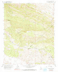
~ The Dark Hole CA topo map, 1:24000 scale, 7.5 X 7.5 Minute, Historical, 1961, updated 1990
The Dark Hole, California, USGS topographic map dated 1961.
Includes geographic coordinates (latitude and longitude). This topographic map is suitable for hiking, camping, and exploring, or framing it as a wall map.
Printed on-demand using high resolution imagery, on heavy weight and acid free paper, or alternatively on a variety of synthetic materials.
Topos available on paper, Waterproof, Poly, or Tyvek. Usually shipping rolled, unless combined with other folded maps in one order.
- Product Number: USGS-5524511
- Free digital map download (high-resolution, GeoPDF): The Dark Hole, California (file size: 13 MB)
- Map Size: please refer to the dimensions of the GeoPDF map above
- Weight (paper map): ca. 55 grams
- Map Type: POD USGS Topographic Map
- Map Series: HTMC
- Map Verison: Historical
- Cell ID: 44707
- Scan ID: 295434
- Imprint Year: 1990
- Woodland Tint: Yes
- Photo Inspection Year: 1978
- Aerial Photo Year: 1958
- Field Check Year: 1961
- Datum: NAD27
- Map Projection: Polyconic
- Map published by United States Geological Survey
- Map Language: English
- Scanner Resolution: 600 dpi
- Map Cell Name: The Dark Hole
- Grid size: 7.5 X 7.5 Minute
- Date on map: 1961
- Map Scale: 1:24000
- Geographical region: California, United States
Neighboring Maps:
All neighboring USGS topo maps are available for sale online at a variety of scales.
Spatial coverage:
Topo map The Dark Hole, California, covers the geographical area associated the following places:
- Cold Spring - Riley Cabin - Riley Cabin (historical) - Number Seven Spring - Reedwater Canyon - Turkey Flat - White Mine - Oak Flat - Harlan Cabin (historical) - Shields Cabin (historical) - Merrill Cabin - Table Mountain - The Dark Hole - Reef Ridge - Moore Cabin - Spring in Bush - Taylor Cabin - Reese Canyon - Taylor Ranch - Taylor Cabin - Vaquero Spring - La Jolla Creek - Radcliff Cabin (historical) - Picacho Rock - Black Mountain - Twentysix Camp (historical) - Yost Cabin - Kings Mine - Pinoso House (historical) - Castle Mountain - Nye Cabin (historical) - Sugar Tail Spring
- Map Area ID: AREA3635.875-120.375-120.25
- Northwest corner Lat/Long code: USGSNW36-120.375
- Northeast corner Lat/Long code: USGSNE36-120.25
- Southwest corner Lat/Long code: USGSSW35.875-120.375
- Southeast corner Lat/Long code: USGSSE35.875-120.25
- Northern map edge Latitude: 36
- Southern map edge Latitude: 35.875
- Western map edge Longitude: -120.375
- Eastern map edge Longitude: -120.25


