
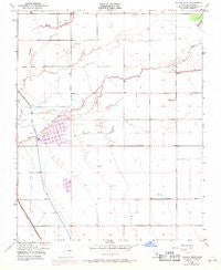
~ Taylor Weir CA topo map, 1:24000 scale, 7.5 X 7.5 Minute, Historical, 1950, updated 1971
Taylor Weir, California, USGS topographic map dated 1950.
Includes geographic coordinates (latitude and longitude). This topographic map is suitable for hiking, camping, and exploring, or framing it as a wall map.
Printed on-demand using high resolution imagery, on heavy weight and acid free paper, or alternatively on a variety of synthetic materials.
Topos available on paper, Waterproof, Poly, or Tyvek. Usually shipping rolled, unless combined with other folded maps in one order.
- Product Number: USGS-5524349
- Free digital map download (high-resolution, GeoPDF): Taylor Weir, California (file size: 7 MB)
- Map Size: please refer to the dimensions of the GeoPDF map above
- Weight (paper map): ca. 55 grams
- Map Type: POD USGS Topographic Map
- Map Series: HTMC
- Map Verison: Historical
- Cell ID: 44397
- Scan ID: 300809
- Imprint Year: 1971
- Woodland Tint: Yes
- Photo Revision Year: 1969
- Aerial Photo Year: 1969
- Field Check Year: 1950
- Survey Year: 1950
- Datum: NAD27
- Map Projection: Polyconic
- Map published by United States Geological Survey
- Map Language: English
- Scanner Resolution: 600 dpi
- Map Cell Name: Taylor Weir
- Grid size: 7.5 X 7.5 Minute
- Date on map: 1950
- Map Scale: 1:24000
- Geographical region: California, United States
Neighboring Maps:
All neighboring USGS topo maps are available for sale online at a variety of scales.
Spatial coverage:
Topo map Taylor Weir, California, covers the geographical area associated the following places:
- Holstein Farms Dairy - Angiola Dairy - Double L Cattle Dairy - Cornerstone Dairy - Dykstra Dairy - Taylor Weir - Macedo Brothers Dairy - Nace Dairy - Friesian Farms Dairy - Middle Fork Deep Creek - Kroes Dairy - Bayou Vista Dairy - South Fork Deep Creek - Meadowlake Dairy - Taylor Canal - Silver Oaks Dairy - Bates Slough - Sousa and Sousa Dairy - North Fork Deep Creek - Elk Bayou School - Vander Eyk Dairy Complex - Brasil and Sons Dairy - Schott Dairy - Rancho Vista Dairy - Elk Bayou - Lake View School (historical) - GMC Dairy - Old Channel Tule River
- Map Area ID: AREA36.12536-119.5-119.375
- Northwest corner Lat/Long code: USGSNW36.125-119.5
- Northeast corner Lat/Long code: USGSNE36.125-119.375
- Southwest corner Lat/Long code: USGSSW36-119.5
- Southeast corner Lat/Long code: USGSSE36-119.375
- Northern map edge Latitude: 36.125
- Southern map edge Latitude: 36
- Western map edge Longitude: -119.5
- Eastern map edge Longitude: -119.375


