
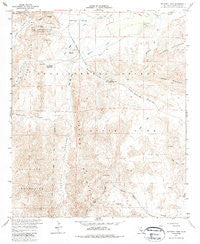
~ Sweeney Pass CA topo map, 1:24000 scale, 7.5 X 7.5 Minute, Historical, 1959, updated 1985
Sweeney Pass, California, USGS topographic map dated 1959.
Includes geographic coordinates (latitude and longitude). This topographic map is suitable for hiking, camping, and exploring, or framing it as a wall map.
Printed on-demand using high resolution imagery, on heavy weight and acid free paper, or alternatively on a variety of synthetic materials.
Topos available on paper, Waterproof, Poly, or Tyvek. Usually shipping rolled, unless combined with other folded maps in one order.
- Product Number: USGS-5524209
- Free digital map download (high-resolution, GeoPDF): Sweeney Pass, California (file size: 13 MB)
- Map Size: please refer to the dimensions of the GeoPDF map above
- Weight (paper map): ca. 55 grams
- Map Type: POD USGS Topographic Map
- Map Series: HTMC
- Map Verison: Historical
- Cell ID: 71772
- Scan ID: 295362
- Imprint Year: 1985
- Woodland Tint: Yes
- Aerial Photo Year: 1957
- Field Check Year: 1959
- Datum: NAD27
- Map Projection: Polyconic
- Map published by United States Geological Survey
- Map Language: English
- Scanner Resolution: 600 dpi
- Map Cell Name: Sweeney Pass
- Grid size: 7.5 X 7.5 Minute
- Date on map: 1959
- Map Scale: 1:24000
- Geographical region: California, United States
Neighboring Maps:
All neighboring USGS topo maps are available for sale online at a variety of scales.
Spatial coverage:
Topo map Sweeney Pass, California, covers the geographical area associated the following places:
- Sweeney Canyon - Palm Bowl Grove - Torote Canyon - Surprise Canyon Grove - Vallecito Creek - Carrizo Canyon - Lava Flow Wash - Smoke Tree Forest - Carrizo Valley - Mountain Palm Springs Campground - Mountain Palm Springs Area - Indian Gorge - Jojoba Wash - Bow Willow Ranger Station - North Grove - Bow Willow Canyon - Indian Valley - Bow Willow Creek - Dos Cabezas Mine - Volcanic Hills - Indian Hill - Pygmy Grove - Southwest Grove - Egg Mountain - Marys Grove - Sweeney Pass - Carrizo Gorge Wilderness - Red Hill - Canyon Nombre - Rockhouse Canyon - Mountain Palm Springs
- Map Area ID: AREA32.87532.75-116.25-116.125
- Northwest corner Lat/Long code: USGSNW32.875-116.25
- Northeast corner Lat/Long code: USGSNE32.875-116.125
- Southwest corner Lat/Long code: USGSSW32.75-116.25
- Southeast corner Lat/Long code: USGSSE32.75-116.125
- Northern map edge Latitude: 32.875
- Southern map edge Latitude: 32.75
- Western map edge Longitude: -116.25
- Eastern map edge Longitude: -116.125


