
~ Standard CA topo map, 1:24000 scale, 7.5 X 7.5 Minute, Historical, 1948, updated 1971
Standard, California, USGS topographic map dated 1948.
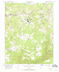
Includes geographic coordinates (latitude and longitude). This topographic map is suitable for hiking, camping, and exploring, or framing it as a wall map.
Printed on-demand using high resolution imagery, on heavy weight and acid free paper, or alternatively on a variety of synthetic materials.
Topos available on paper, Waterproof, Poly, or Tyvek. Usually shipping rolled, unless combined with other folded maps in one order.
- Product Number: USGS-5523879
- Free digital map download (high-resolution, GeoPDF): Standard, California (file size: 11 MB)
- Map Size: please refer to the dimensions of the GeoPDF map above
- Weight (paper map): ca. 55 grams
- Map Type: POD USGS Topographic Map
- Map Series: HTMC
- Map Verison: Historical
- Cell ID: 42858
- Scan ID: 300650
- Imprint Year: 1971
- Woodland Tint: Yes
- Aerial Photo Year: 1945
- Field Check Year: 1948
- Datum: NAD27
- Map Projection: Polyconic
- Map published by United States Geological Survey
- Map published by United States Army Corps of Engineers
- Map Language: English
- Scanner Resolution: 600 dpi
- Map Cell Name: Standard
- Grid size: 7.5 X 7.5 Minute
- Date on map: 1948
- Map Scale: 1:24000
- Geographical region: California, United States
Neighboring Maps:
All neighboring USGS topo maps are available for sale online at a variety of scales.
Spatial coverage:
Topo map Standard, California, covers the geographical area associated the following places:
- Scenic Brook - Oak Gardens Estates - Sunshine Camp - Peaceful Valley - Mono Village - Scenic View - Standard - Willow Springs - Soulsbyville - Ralph - Diamond Bar B Ranch - Greenley Oaks - Buckhorn Estates - Quail Hollow - East Sonora - Sonora Hills - Quail Ridge Ranch - Curtis Creek Ranch - Monte Grande Heights - Lambert Lake Estates - Sonora Ranchettes - Rancho Poquitos - Mono Vista
- Map Area ID: AREA3837.875-120.375-120.25
- Northwest corner Lat/Long code: USGSNW38-120.375
- Northeast corner Lat/Long code: USGSNE38-120.25
- Southwest corner Lat/Long code: USGSSW37.875-120.375
- Southeast corner Lat/Long code: USGSSE37.875-120.25
- Northern map edge Latitude: 38
- Southern map edge Latitude: 37.875
- Western map edge Longitude: -120.375
- Eastern map edge Longitude: -120.25


