
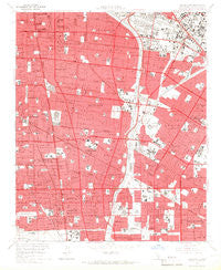
~ South Gate CA topo map, 1:24000 scale, 7.5 X 7.5 Minute, Historical, 1964, updated 1966
South Gate, California, USGS topographic map dated 1964.
Includes geographic coordinates (latitude and longitude). This topographic map is suitable for hiking, camping, and exploring, or framing it as a wall map.
Printed on-demand using high resolution imagery, on heavy weight and acid free paper, or alternatively on a variety of synthetic materials.
Topos available on paper, Waterproof, Poly, or Tyvek. Usually shipping rolled, unless combined with other folded maps in one order.
- Product Number: USGS-5523757
- Free digital map download (high-resolution, GeoPDF): South Gate, California (file size: 12 MB)
- Map Size: please refer to the dimensions of the GeoPDF map above
- Weight (paper map): ca. 55 grams
- Map Type: POD USGS Topographic Map
- Map Series: HTMC
- Map Verison: Historical
- Cell ID: 42189
- Scan ID: 300617
- Imprint Year: 1966
- Aerial Photo Year: 1963
- Survey Year: 1964
- Datum: NAD27
- Map Projection: Polyconic
- Map published by United States Geological Survey
- Map Language: English
- Scanner Resolution: 600 dpi
- Map Cell Name: South Gate
- Grid size: 7.5 X 7.5 Minute
- Date on map: 1964
- Map Scale: 1:24000
- Geographical region: California, United States
Neighboring Maps:
All neighboring USGS topo maps are available for sale online at a variety of scales.
Spatial coverage:
Topo map South Gate, California, covers the geographical area associated the following places:
- Willow Brook - Florence - Lynwood Gardens - Graham - Hacienda Village - Imperial Courts - Bell Gardens - Huntington Park - Clearwater - Cudahy - El Rancho Mobile Home Park - Workman - Walnut Park - Paramount - Laguna - Compton - Hollydale - Vinvale - Rendalia - Pueblo Del Rio Public Housing - Nickerson Gardens - Maywood - Watts - East Rancho Dominguez - Simons - Bell - Firestone Park - Lynwood - South Gate - Downey - Walker - Nadeau - Jordan Downs - Morton - Gage
- Map Area ID: AREA3433.875-118.25-118.125
- Northwest corner Lat/Long code: USGSNW34-118.25
- Northeast corner Lat/Long code: USGSNE34-118.125
- Southwest corner Lat/Long code: USGSSW33.875-118.25
- Southeast corner Lat/Long code: USGSSE33.875-118.125
- Northern map edge Latitude: 34
- Southern map edge Latitude: 33.875
- Western map edge Longitude: -118.25
- Eastern map edge Longitude: -118.125


