
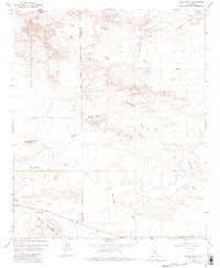
~ Shell Reef CA topo map, 1:24000 scale, 7.5 X 7.5 Minute, Historical, 1959, updated 1981
Shell Reef, California, USGS topographic map dated 1959.
Includes geographic coordinates (latitude and longitude). This topographic map is suitable for hiking, camping, and exploring, or framing it as a wall map.
Printed on-demand using high resolution imagery, on heavy weight and acid free paper, or alternatively on a variety of synthetic materials.
Topos available on paper, Waterproof, Poly, or Tyvek. Usually shipping rolled, unless combined with other folded maps in one order.
- Product Number: USGS-5523261
- Free digital map download (high-resolution, GeoPDF): Shell Reef, California (file size: 8 MB)
- Map Size: please refer to the dimensions of the GeoPDF map above
- Weight (paper map): ca. 55 grams
- Map Type: POD USGS Topographic Map
- Map Series: HTMC
- Map Verison: Historical
- Cell ID: 40970
- Scan ID: 300446
- Imprint Year: 1981
- Photo Inspection Year: 1976
- Aerial Photo Year: 1961
- Survey Year: 1959
- Datum: NAD27
- Map Projection: Polyconic
- Map published by United States Geological Survey
- Map Language: English
- Scanner Resolution: 600 dpi
- Map Cell Name: Shell Reef
- Grid size: 7.5 X 7.5 Minute
- Date on map: 1959
- Map Scale: 1:24000
- Geographical region: California, United States
Neighboring Maps:
All neighboring USGS topo maps are available for sale online at a variety of scales.
Spatial coverage:
Topo map Shell Reef, California, covers the geographical area associated the following places:
- Barrel Springs Cultural Preserve - Wolfe Well - Five Palms Spring - Palo Verde Wash - Squaw Peak - Barrel Spring - North Fork Arroyo Salada - Los Puertecitos Historical Marker - Una Palma - Pumpkin Patch - Shell Reef
- Map Area ID: AREA33.2533.125-116.125-116
- Northwest corner Lat/Long code: USGSNW33.25-116.125
- Northeast corner Lat/Long code: USGSNE33.25-116
- Southwest corner Lat/Long code: USGSSW33.125-116.125
- Southeast corner Lat/Long code: USGSSE33.125-116
- Northern map edge Latitude: 33.25
- Southern map edge Latitude: 33.125
- Western map edge Longitude: -116.125
- Eastern map edge Longitude: -116


