
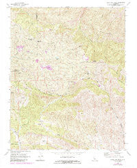
~ Santa Rita Peak CA topo map, 1:24000 scale, 7.5 X 7.5 Minute, Historical, 1969, updated 1984
Santa Rita Peak, California, USGS topographic map dated 1969.
Includes geographic coordinates (latitude and longitude). This topographic map is suitable for hiking, camping, and exploring, or framing it as a wall map.
Printed on-demand using high resolution imagery, on heavy weight and acid free paper, or alternatively on a variety of synthetic materials.
Topos available on paper, Waterproof, Poly, or Tyvek. Usually shipping rolled, unless combined with other folded maps in one order.
- Product Number: USGS-5522837
- Free digital map download (high-resolution, GeoPDF): Santa Rita Peak, California (file size: 17 MB)
- Map Size: please refer to the dimensions of the GeoPDF map above
- Weight (paper map): ca. 55 grams
- Map Type: POD USGS Topographic Map
- Map Series: HTMC
- Map Verison: Historical
- Cell ID: 39909
- Scan ID: 295084
- Imprint Year: 1984
- Woodland Tint: Yes
- Photo Revision Year: 1984
- Aerial Photo Year: 1981
- Edit Year: 1984
- Field Check Year: 1969
- Datum: NAD27
- Map Projection: Polyconic
- Map published by United States Geological Survey
- Map Language: English
- Scanner Resolution: 600 dpi
- Map Cell Name: Santa Rita Peak
- Grid size: 7.5 X 7.5 Minute
- Date on map: 1969
- Map Scale: 1:24000
- Geographical region: California, United States
Neighboring Maps:
All neighboring USGS topo maps are available for sale online at a variety of scales.
Spatial coverage:
Topo map Santa Rita Peak, California, covers the geographical area associated the following places:
- James Corbett Byles Mine - Three Sisters - Gem Mine - Santa Rita Peak - Joaquin Mill - Spanish Lake - Wright Mountain - Dick Wright Spring - KCAC Mine - Del Mexico Mine - Roach Canyon - Rita Mine - Adobe Flat - Loma Atravesada - Archer Camp - Archer Mine - Atlas Asbestos Mine - Railroad Mine - Holman Mill - Rucker Spring - Twentyfive Spring - Mistake Mine - Joaquin Ridge - Agua Buena Spring - Condon Peak
- Map Area ID: AREA36.37536.25-120.625-120.5
- Northwest corner Lat/Long code: USGSNW36.375-120.625
- Northeast corner Lat/Long code: USGSNE36.375-120.5
- Southwest corner Lat/Long code: USGSSW36.25-120.625
- Southeast corner Lat/Long code: USGSSE36.25-120.5
- Northern map edge Latitude: 36.375
- Southern map edge Latitude: 36.25
- Western map edge Longitude: -120.625
- Eastern map edge Longitude: -120.5


