
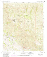
~ San Rafael Mtn CA topo map, 1:24000 scale, 7.5 X 7.5 Minute, Historical, 1959, updated 1989
San Rafael Mtn, California, USGS topographic map dated 1959.
Includes geographic coordinates (latitude and longitude). This topographic map is suitable for hiking, camping, and exploring, or framing it as a wall map.
Printed on-demand using high resolution imagery, on heavy weight and acid free paper, or alternatively on a variety of synthetic materials.
Topos available on paper, Waterproof, Poly, or Tyvek. Usually shipping rolled, unless combined with other folded maps in one order.
- Product Number: USGS-5522637
- Free digital map download (high-resolution, GeoPDF): San Rafael Mtn, California (file size: 17 MB)
- Map Size: please refer to the dimensions of the GeoPDF map above
- Weight (paper map): ca. 55 grams
- Map Type: POD USGS Topographic Map
- Map Series: HTMC
- Map Verison: Historical
- Cell ID: 39703
- Scan ID: 295047
- Imprint Year: 1989
- Woodland Tint: Yes
- Photo Revision Year: 1988
- Aerial Photo Year: 1984
- Edit Year: 1988
- Field Check Year: 1959
- Datum: NAD27
- Map Projection: Polyconic
- Map published by United States Geological Survey
- Map Language: English
- Scanner Resolution: 600 dpi
- Map Cell Name: San Rafael Mountain
- Grid size: 7.5 X 7.5 Minute
- Date on map: 1959
- Map Scale: 1:24000
- Geographical region: California, United States
Neighboring Maps:
All neighboring USGS topo maps are available for sale online at a variety of scales.
Spatial coverage:
Topo map San Rafael Mtn, California, covers the geographical area associated the following places:
- Big Cone Spruce Camp - Peachtree Canyon - Mine Canyon Spring - Grand Spring - La Jolla Basin - Manzana Narrows Camp - McKinley Spring - Manzana Camp - San Rafael Mountain - Santa Cruz Rustic Campsite - Cold Spring - Black Canyon - Live Oak Spring - Mine Canyon - Manzana Camp - Manzana Narrows Camp - East Fork Santa Cruz Creek - Flores Camp - San Rafael Mountains - Big Cone Spruce Camp - Mission Pine Camp - Santa Cruz Peak - Mission Pine Camp - Santa Cruz Trail - Mud Spring - Coche Creek - Doty Cabin - Santa Cruz Guard Station - Flores Camp - McKinley Mountain - Demesio Spring - West Fork Santa Cruz Creek
- Map Area ID: AREA34.7534.625-119.875-119.75
- Northwest corner Lat/Long code: USGSNW34.75-119.875
- Northeast corner Lat/Long code: USGSNE34.75-119.75
- Southwest corner Lat/Long code: USGSSW34.625-119.875
- Southeast corner Lat/Long code: USGSSE34.625-119.75
- Northern map edge Latitude: 34.75
- Southern map edge Latitude: 34.625
- Western map edge Longitude: -119.875
- Eastern map edge Longitude: -119.75


