
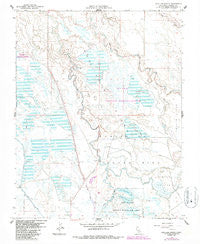
~ San Luis Ranch CA topo map, 1:24000 scale, 7.5 X 7.5 Minute, Historical, 1961, updated 1987
San Luis Ranch, California, USGS topographic map dated 1961.
Includes geographic coordinates (latitude and longitude). This topographic map is suitable for hiking, camping, and exploring, or framing it as a wall map.
Printed on-demand using high resolution imagery, on heavy weight and acid free paper, or alternatively on a variety of synthetic materials.
Topos available on paper, Waterproof, Poly, or Tyvek. Usually shipping rolled, unless combined with other folded maps in one order.
- Product Number: USGS-5522501
- Free digital map download (high-resolution, GeoPDF): San Luis Ranch, California (file size: 10 MB)
- Map Size: please refer to the dimensions of the GeoPDF map above
- Weight (paper map): ca. 55 grams
- Map Type: POD USGS Topographic Map
- Map Series: HTMC
- Map Verison: Historical
- Cell ID: 39665
- Scan ID: 295028
- Imprint Year: 1987
- Photo Revision Year: 1987
- Aerial Photo Year: 1984
- Edit Year: 1987
- Survey Year: 1961
- Datum: NAD27
- Map Projection: Polyconic
- Map published by United States Geological Survey
- Map Language: English
- Scanner Resolution: 600 dpi
- Map Cell Name: San Luis Ranch
- Grid size: 7.5 X 7.5 Minute
- Date on map: 1961
- Map Scale: 1:24000
- Geographical region: California, United States
Neighboring Maps:
All neighboring USGS topo maps are available for sale online at a variety of scales.
Spatial coverage:
Topo map San Luis Ranch, California, covers the geographical area associated the following places:
- Fremont Canal - Underwood Gun Club - San Luis National Wildlife Refuge - Old Poso Slough - Island Canal D - Circle Island - San Luis Island - Deep Slough - Hereford Drain - Underwood Ranch (historical) - Exeter Farms - Standard Gun Club - Old Dickenson Ferry (historical) - Los Banos State Waterfowl Area - Terrels Gun Club - Santa Cruz Gun Club - San Luis Drain Number One - Island Canal C - Deadmans Slough - San Luis Ranch - Big Buttonwillow Lake - Island Canal B - Salt Slough Island Canal - Circle Island Drain - Zimmerman Gun Club - Hereford Ranch - San Jose Gun Club - Grasslands Wildlife Management Area - Little Buttonwillow Lake - West Delta Drain - Mud Slough - San Luis Canal - Yellow Jacket Gun Club
- Map Area ID: AREA37.2537.125-120.875-120.75
- Northwest corner Lat/Long code: USGSNW37.25-120.875
- Northeast corner Lat/Long code: USGSNE37.25-120.75
- Southwest corner Lat/Long code: USGSSW37.125-120.875
- Southeast corner Lat/Long code: USGSSE37.125-120.75
- Northern map edge Latitude: 37.25
- Southern map edge Latitude: 37.125
- Western map edge Longitude: -120.875
- Eastern map edge Longitude: -120.75


