
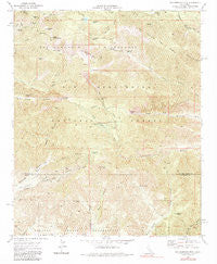
~ San Gorgonio Mtn CA topo map, 1:24000 scale, 7.5 X 7.5 Minute, Historical, 1970, updated 1984
San Gorgonio Mtn, California, USGS topographic map dated 1970.
Includes geographic coordinates (latitude and longitude). This topographic map is suitable for hiking, camping, and exploring, or framing it as a wall map.
Printed on-demand using high resolution imagery, on heavy weight and acid free paper, or alternatively on a variety of synthetic materials.
Topos available on paper, Waterproof, Poly, or Tyvek. Usually shipping rolled, unless combined with other folded maps in one order.
- Product Number: USGS-5522357
- Free digital map download (high-resolution, GeoPDF): San Gorgonio Mtn, California (file size: 17 MB)
- Map Size: please refer to the dimensions of the GeoPDF map above
- Weight (paper map): ca. 55 grams
- Map Type: POD USGS Topographic Map
- Map Series: HTMC
- Map Verison: Historical
- Cell ID: 39626
- Scan ID: 300082
- Imprint Year: 1984
- Woodland Tint: Yes
- Photo Inspection Year: 1978
- Aerial Photo Year: 1969
- Field Check Year: 1970
- Datum: NAD27
- Map Projection: Lambert Conformal Conic
- Map published by United States Geological Survey
- Map Language: English
- Scanner Resolution: 600 dpi
- Map Cell Name: San Gorgonio Mountain
- Grid size: 7.5 X 7.5 Minute
- Date on map: 1970
- Map Scale: 1:24000
- Geographical region: California, United States
Neighboring Maps:
All neighboring USGS topo maps are available for sale online at a variety of scales.
Spatial coverage:
Topo map San Gorgonio Mtn, California, covers the geographical area associated the following places:
- Sawmill Canyon - Mill Creek Jumpoff - Red Rock Flat - North Fork Meadows - Big Oaks Canyon - Raywood Flat - Fish Creek Trail - North Fork Meadows Trail - Little Charlton Peak - Dollar Lake Saddle - Big Oaks Powerhouse - Dry Lake - Bear Wallow Spring - Cuchillo Peak - Dollar Lake - South Fork Cabin - Bear Wallows Campground - High Meadow Springs - Snow Peak - San Gorgonio Mountain - Dobbs Peak - Gunsight Pass - East Fork Whitewater River - Fish Creek Meadows - Jepson Peak - Mill Creek Mine - Burnt Canyon - West Branch Hathaway Creek - Wanat Peak - Lake Peak - Raywood Flat Trail - Lodgepole Spring - Charlton Peak - Deer Spring - The Tarn - Dry Lake Trail - East Fork Cabin - Mission Springs Campground - Vivian Creek Trail - Mine Shaft Saddle - Middle Branch Millard Canyon - High Creek - Silverwood Falls - East Fork South Fork Whitewater River - Middle Fork Jumpoff - Sky High Trail - Ten Thousand Foot Ridge - Plummer Meadows - Galena Peak
- Map Area ID: AREA34.12534-116.875-116.75
- Northwest corner Lat/Long code: USGSNW34.125-116.875
- Northeast corner Lat/Long code: USGSNE34.125-116.75
- Southwest corner Lat/Long code: USGSSW34-116.875
- Southeast corner Lat/Long code: USGSSE34-116.75
- Northern map edge Latitude: 34.125
- Southern map edge Latitude: 34
- Western map edge Longitude: -116.875
- Eastern map edge Longitude: -116.75


