
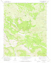
~ San Benito Mtn CA topo map, 1:24000 scale, 7.5 X 7.5 Minute, Historical, 1969, updated 1980
San Benito Mtn, California, USGS topographic map dated 1969.
Includes geographic coordinates (latitude and longitude). This topographic map is suitable for hiking, camping, and exploring, or framing it as a wall map.
Printed on-demand using high resolution imagery, on heavy weight and acid free paper, or alternatively on a variety of synthetic materials.
Topos available on paper, Waterproof, Poly, or Tyvek. Usually shipping rolled, unless combined with other folded maps in one order.
- Product Number: USGS-5522227
- Free digital map download (high-resolution, GeoPDF): San Benito Mtn, California (file size: 14 MB)
- Map Size: please refer to the dimensions of the GeoPDF map above
- Weight (paper map): ca. 55 grams
- Map Type: POD USGS Topographic Map
- Map Series: HTMC
- Map Verison: Historical
- Cell ID: 39594
- Scan ID: 294947
- Imprint Year: 1980
- Woodland Tint: Yes
- Aerial Photo Year: 1967
- Field Check Year: 1969
- Datum: NAD27
- Map Projection: Polyconic
- Map published by United States Geological Survey
- Map Language: English
- Scanner Resolution: 600 dpi
- Map Cell Name: San Benito Mountain
- Grid size: 7.5 X 7.5 Minute
- Date on map: 1969
- Map Scale: 1:24000
- Geographical region: California, United States
Neighboring Maps:
All neighboring USGS topo maps are available for sale online at a variety of scales.
Spatial coverage:
Topo map San Benito Mtn, California, covers the geographical area associated the following places:
- Goat Mountain - Fawn Lake - Poison Spring - Garcia Canyon - Sawmill Creek - Asbestos Ridge Mine - San Benito Mountain - Alta Peak - Fitzpatrick Spring - Mulch Spring - Alpine Mine - Fourth of July Mine - Cascara Spring - Bald Peak - Rudolf Canyon - The Picachos - Dunham Canyon - Sylvester Spring - Florence Mack Mine - The Rock Trail - Picacho Peak - Fawn Spring - Williams Mountain - Picacho Creek - Picacho Mine - Lewis Flat - Willow Spring - Santa Margarita Mine - Breen Mine - Duckworth Canyon - Nimrod Canyon - Willow Spring - Garrison Canyon - Williams Hollow - San Benito Mill - Saint Thomas Mine - Diablo Range - East Fork North Fork Lewis River
- Map Area ID: AREA36.37536.25-120.75-120.625
- Northwest corner Lat/Long code: USGSNW36.375-120.75
- Northeast corner Lat/Long code: USGSNE36.375-120.625
- Southwest corner Lat/Long code: USGSSW36.25-120.75
- Southeast corner Lat/Long code: USGSSE36.25-120.625
- Northern map edge Latitude: 36.375
- Southern map edge Latitude: 36.25
- Western map edge Longitude: -120.75
- Eastern map edge Longitude: -120.625


