
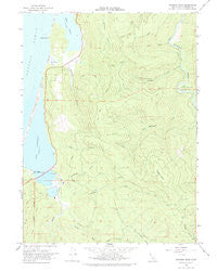
~ Rodgers Peak CA topo map, 1:24000 scale, 7.5 X 7.5 Minute, Historical, 1966, updated 1975
Rodgers Peak, California, USGS topographic map dated 1966.
Includes geographic coordinates (latitude and longitude). This topographic map is suitable for hiking, camping, and exploring, or framing it as a wall map.
Printed on-demand using high resolution imagery, on heavy weight and acid free paper, or alternatively on a variety of synthetic materials.
Topos available on paper, Waterproof, Poly, or Tyvek. Usually shipping rolled, unless combined with other folded maps in one order.
- Product Number: USGS-5521901
- Free digital map download (high-resolution, GeoPDF): Rodgers Peak, California (file size: 11 MB)
- Map Size: please refer to the dimensions of the GeoPDF map above
- Weight (paper map): ca. 55 grams
- Map Type: POD USGS Topographic Map
- Map Series: HTMC
- Map Verison: Historical
- Cell ID: 38419
- Scan ID: 101922
- Imprint Year: 1975
- Woodland Tint: Yes
- Aerial Photo Year: 1964
- Field Check Year: 1966
- Datum: NAD27
- Map Projection: Polyconic
- Map published by United States Geological Survey
- Map Language: English
- Scanner Resolution: 600 dpi
- Map Cell Name: Rodgers Peak
- Grid size: 7.5 X 7.5 Minute
- Date on map: 1966
- Map Scale: 1:24000
- Geographical region: California, United States
Neighboring Maps:
All neighboring USGS topo maps are available for sale online at a variety of scales.
Spatial coverage:
Topo map Rodgers Peak, California, covers the geographical area associated the following places:
- North Fork Maple Creek - Bond Creek - Rodgers Peak - Humboldt Lagoons State Park - Big Lagoon - Kane Ranch - Pitcher Creek - Peugh Ranch (historical) - Tom Creek - McDonald Creek - Harry A. Merlo State Recreation Area - Big Lagoon 203 Dam - Diamond Creek - Howard Libbey Tree - Herbert Hard Ranch - Maple Creek - Tom McDonald Creek - Big Lagoon Marsh - Little Red Hen Inn (historical) - Fortyfour Creek - Arco Grove of the Giants - Dry Lagoon - Big Lagoon Rancheria - Big Lagoon Forest West Natural Preserve - Sharp Point - Big Lagoon Forest East Natural Preserve - Big Lagoon Forest South Natural Preserve - Gray Creek - Stone Lagoon - Big Lagoon Spit
- Map Area ID: AREA41.2541.125-124.125-124
- Northwest corner Lat/Long code: USGSNW41.25-124.125
- Northeast corner Lat/Long code: USGSNE41.25-124
- Southwest corner Lat/Long code: USGSSW41.125-124.125
- Southeast corner Lat/Long code: USGSSE41.125-124
- Northern map edge Latitude: 41.25
- Southern map edge Latitude: 41.125
- Western map edge Longitude: -124.125
- Eastern map edge Longitude: -124


