
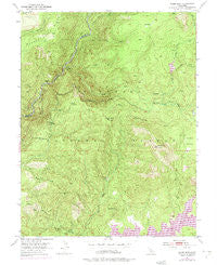
~ Robbs Peak CA topo map, 1:24000 scale, 7.5 X 7.5 Minute, Historical, 1950, updated 1975
Robbs Peak, California, USGS topographic map dated 1950.
Includes geographic coordinates (latitude and longitude). This topographic map is suitable for hiking, camping, and exploring, or framing it as a wall map.
Printed on-demand using high resolution imagery, on heavy weight and acid free paper, or alternatively on a variety of synthetic materials.
Topos available on paper, Waterproof, Poly, or Tyvek. Usually shipping rolled, unless combined with other folded maps in one order.
- Product Number: USGS-5521865
- Free digital map download (high-resolution, GeoPDF): Robbs Peak, California (file size: 15 MB)
- Map Size: please refer to the dimensions of the GeoPDF map above
- Weight (paper map): ca. 55 grams
- Map Type: POD USGS Topographic Map
- Map Series: HTMC
- Map Verison: Historical
- Cell ID: 38123
- Scan ID: 294760
- Imprint Year: 1975
- Woodland Tint: Yes
- Photo Revision Year: 1973
- Aerial Photo Year: 1973
- Field Check Year: 1950
- Datum: NAD27
- Map Projection: Polyconic
- Map published by United States Geological Survey
- Map Language: English
- Scanner Resolution: 600 dpi
- Map Cell Name: Robbs Peak
- Grid size: 7.5 X 7.5 Minute
- Date on map: 1950
- Map Scale: 1:24000
- Geographical region: California, United States
Neighboring Maps:
All neighboring USGS topo maps are available for sale online at a variety of scales.
Spatial coverage:
Topo map Robbs Peak, California, covers the geographical area associated the following places:
- Dry Lakes - Rocky Basin Creek - Yellow Jacket Campground - Hales Crossing - Butler Meadow - Wench Creek Campground - Silver Hill Ridge - South Fork Trail - Ellicott Bridge - South Fork Rubicon River - Gerle 1009-005 Dam - Silver Hill - Angel Creek - South Fork Camp Ground - Gerle Creek Campground - Desert Cold Spring - Hartless Mountain - Robbs Peak - Hartless Guard Station - Stony Creek - Robbs Valley - Dry Lakes Trail - Gerle Creek - Hunters Valley - Ellicott Trail - Tells Creek - Deer Knob - Deer Creek - Robbs Peak 1009-006 Dam - Uncle Toms Cabin - Grey Trail - Hunsucker Trail - Ditch Camp - Honey Creek - South Fork Bridge - Cold Spring - South Creek - Gerle Creek Divide Reservoir - Slide Point Trail - Bobs Cabin Trail - Robbs Peak Powerhouse
- Map Area ID: AREA3938.875-120.5-120.375
- Northwest corner Lat/Long code: USGSNW39-120.5
- Northeast corner Lat/Long code: USGSNE39-120.375
- Southwest corner Lat/Long code: USGSSW38.875-120.5
- Southeast corner Lat/Long code: USGSSE38.875-120.375
- Northern map edge Latitude: 39
- Southern map edge Latitude: 38.875
- Western map edge Longitude: -120.5
- Eastern map edge Longitude: -120.375


