
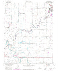
~ Ripon CA topo map, 1:24000 scale, 7.5 X 7.5 Minute, Historical, 1969, updated 1980
Ripon, California, USGS topographic map dated 1969.
Includes geographic coordinates (latitude and longitude). This topographic map is suitable for hiking, camping, and exploring, or framing it as a wall map.
Printed on-demand using high resolution imagery, on heavy weight and acid free paper, or alternatively on a variety of synthetic materials.
Topos available on paper, Waterproof, Poly, or Tyvek. Usually shipping rolled, unless combined with other folded maps in one order.
- Product Number: USGS-5521785
- Free digital map download (high-resolution, GeoPDF): Ripon, California (file size: 8 MB)
- Map Size: please refer to the dimensions of the GeoPDF map above
- Weight (paper map): ca. 55 grams
- Map Type: POD USGS Topographic Map
- Map Series: HTMC
- Map Verison: Historical
- Cell ID: 37999
- Scan ID: 294718
- Imprint Year: 1980
- Photo Revision Year: 1980
- Aerial Photo Year: 1978
- Edit Year: 1980
- Survey Year: 1969
- Datum: NAD27
- Map Projection: Polyconic
- Map published by United States Geological Survey
- Map Language: English
- Scanner Resolution: 600 dpi
- Map Cell Name: Ripon
- Grid size: 7.5 X 7.5 Minute
- Date on map: 1969
- Map Scale: 1:24000
- Geographical region: California, United States
Neighboring Maps:
All neighboring USGS topo maps are available for sale online at a variety of scales.
Spatial coverage:
Topo map Ripon, California, covers the geographical area associated the following places:
- Free Methodist Church - Oak Forest - Wilma Avenue Park - Orthodox Christian Reformed Church - San Joaquin River National Wildlife Refuge - Ripon High School - Fiscalini Farms - Calvary Reformed Church - First Baptist Church - First Christian Reformed Church - Ripon Assembly of God Church - Machado Dairy Farms Number 1 - Circle J M Dairy - Yandell Ranch Airport - Mapes Ranch Airport - Ripon Police Department - Sturgeon Bend - Miller Lake - Immanuel Christian Reformed Church - San Joaquin School - Blue Heron Rookery - Almond Valley Christian Reformed Church - Weston Elementary School - Ripon City Hall - Riley Slough - Hertle Dairy - Church of Christ - First Congregational Church - Grace Brethren Church - Finnegan Falls - Dutra Farms - Heartland Community Church - Harry Knoff Auditorium - Roest Family Dairy - Bethany Home - Stanislaus River - Ripon Post Office - Mapes Ranch - Ripon Branch Stockton-San Joaquin County Public Library - Caswell Memorial State Park - Acacia Park - City of Ripon - Ripon Elementary School - Jackson School (historical) - KVFX-FM (Manteca) - Owl Rod and Gun Club (historical) - Val Martins Dairy - Quaresma Dairy
- Map Area ID: AREA37.7537.625-121.25-121.125
- Northwest corner Lat/Long code: USGSNW37.75-121.25
- Northeast corner Lat/Long code: USGSNE37.75-121.125
- Southwest corner Lat/Long code: USGSSW37.625-121.25
- Southeast corner Lat/Long code: USGSSE37.625-121.125
- Northern map edge Latitude: 37.75
- Southern map edge Latitude: 37.625
- Western map edge Longitude: -121.25
- Eastern map edge Longitude: -121.125


