
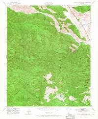
~ Rancho Nuevo Creek CA topo map, 1:24000 scale, 7.5 X 7.5 Minute, Historical, 1943, updated 1967
Rancho Nuevo Creek, California, USGS topographic map dated 1943.
Includes geographic coordinates (latitude and longitude). This topographic map is suitable for hiking, camping, and exploring, or framing it as a wall map.
Printed on-demand using high resolution imagery, on heavy weight and acid free paper, or alternatively on a variety of synthetic materials.
Topos available on paper, Waterproof, Poly, or Tyvek. Usually shipping rolled, unless combined with other folded maps in one order.
- Product Number: USGS-5521407
- Free digital map download (high-resolution, GeoPDF): Rancho Nuevo Creek, California (file size: 15 MB)
- Map Size: please refer to the dimensions of the GeoPDF map above
- Weight (paper map): ca. 55 grams
- Map Type: POD USGS Topographic Map
- Map Series: HTMC
- Map Verison: Historical
- Cell ID: 37003
- Scan ID: 294503
- Imprint Year: 1967
- Woodland Tint: Yes
- Aerial Photo Year: 1942
- Field Check Year: 1943
- Datum: NAD27
- Map Projection: Polyconic
- Map published by United States Geological Survey
- Map published by United States Army Corps of Engineers
- Map Language: English
- Scanner Resolution: 600 dpi
- Map Cell Name: Rancho Nuevo Creek
- Grid size: 7.5 X 7.5 Minute
- Date on map: 1943
- Map Scale: 1:24000
- Geographical region: California, United States
Neighboring Maps:
All neighboring USGS topo maps are available for sale online at a variety of scales.
Spatial coverage:
Topo map Rancho Nuevo Creek, California, covers the geographical area associated the following places:
- Apache Canyon - Upper Rancho Nuevo Campground - Deal Trail - Deal Junction Campsite - Apache School - Deal Campground - Tinta Creek - Mine Campground - Potrero Seco - Deal Canyon - La Jolla Spring - Oak Creek - Potrero Seco Guard Station (historical) - Tinta Trail - Rancho Nuevo Creek - LaJolla Springs - Round Spring Canyon - Corral Canyon - Rancho Nuevo Campground - Potrero Seco Rustic Campsite - Don Victor Valley Fire Trail - Morro Hill - Oak Spring - Castle Canyon - Dry Canyon - Oak Springs - Rancho Nuevo Trail - Tinta Campground - Upper Tinta Campground - Lizard Head - Potrero Seco Campground
- Map Area ID: AREA34.7534.625-119.5-119.375
- Northwest corner Lat/Long code: USGSNW34.75-119.5
- Northeast corner Lat/Long code: USGSNE34.75-119.375
- Southwest corner Lat/Long code: USGSSW34.625-119.5
- Southeast corner Lat/Long code: USGSSE34.625-119.375
- Northern map edge Latitude: 34.75
- Southern map edge Latitude: 34.625
- Western map edge Longitude: -119.5
- Eastern map edge Longitude: -119.375


