
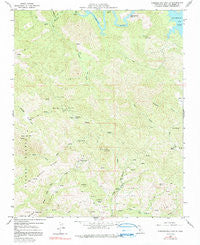
~ Pebblestone Shut In CA topo map, 1:24000 scale, 7.5 X 7.5 Minute, Historical, 1959, updated 1991
Pebblestone Shut In, California, USGS topographic map dated 1959.
Includes geographic coordinates (latitude and longitude). This topographic map is suitable for hiking, camping, and exploring, or framing it as a wall map.
Printed on-demand using high resolution imagery, on heavy weight and acid free paper, or alternatively on a variety of synthetic materials.
Topos available on paper, Waterproof, Poly, or Tyvek. Usually shipping rolled, unless combined with other folded maps in one order.
- Product Number: USGS-5520531
- Free digital map download (high-resolution, GeoPDF): Pebblestone Shut In, California (file size: 14 MB)
- Map Size: please refer to the dimensions of the GeoPDF map above
- Weight (paper map): ca. 55 grams
- Map Type: POD USGS Topographic Map
- Map Series: HTMC
- Map Verison: Historical
- Cell ID: 34570
- Scan ID: 294023
- Imprint Year: 1991
- Woodland Tint: Yes
- Visual Version Number: 2
- Photo Inspection Year: 1976
- Aerial Photo Year: 1956
- Field Check Year: 1959
- Datum: NAD27
- Map Projection: Polyconic
- Map published by United States Geological Survey
- Map Language: English
- Scanner Resolution: 600 dpi
- Map Cell Name: Pebblestone Shut-in
- Grid size: 7.5 X 7.5 Minute
- Date on map: 1959
- Map Scale: 1:24000
- Geographical region: California, United States
Neighboring Maps:
All neighboring USGS topo maps are available for sale online at a variety of scales.
Spatial coverage:
Topo map Pebblestone Shut In, California, covers the geographical area associated the following places:
- Carrol Canyon - Eucalyptus Lateral Ten - Little Burnett Creek - Ocean View Mine - Kavanaugh Creek - Rocky Butte Lookout - Town Spring - Quien Sabe Mine - Goat Camp (historical) - Vulture Rock - Tobacco Creek - North Fork San Simeon Creek - McLaughlin Canyon - Caballada Creek - Marmo-lejo Flats - Rocky Butte - Pine Mountain - Keystone Mine - North Grizzly Bend Creek - Buckeye Mine - Almaden Mine - Hamilton Mine - Red Mountain - Grizzly Bend - Middle Ridge - Pebblestone Shut-in - Almaden Flats - Eagle Rock - Gould Creek - Pine Mountain Mine - Black Oak Mountain - Deer Flat
- Map Area ID: AREA35.7535.625-121.125-121
- Northwest corner Lat/Long code: USGSNW35.75-121.125
- Northeast corner Lat/Long code: USGSNE35.75-121
- Southwest corner Lat/Long code: USGSSW35.625-121.125
- Southeast corner Lat/Long code: USGSSE35.625-121
- Northern map edge Latitude: 35.75
- Southern map edge Latitude: 35.625
- Western map edge Longitude: -121.125
- Eastern map edge Longitude: -121


