
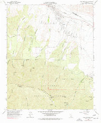
~ Peak Mountain CA topo map, 1:24000 scale, 7.5 X 7.5 Minute, Historical, 1964, updated 1977
Peak Mountain, California, USGS topographic map dated 1964.
Includes geographic coordinates (latitude and longitude). This topographic map is suitable for hiking, camping, and exploring, or framing it as a wall map.
Printed on-demand using high resolution imagery, on heavy weight and acid free paper, or alternatively on a variety of synthetic materials.
Topos available on paper, Waterproof, Poly, or Tyvek. Usually shipping rolled, unless combined with other folded maps in one order.
- Product Number: USGS-5520519
- Free digital map download (high-resolution, GeoPDF): Peak Mountain, California (file size: 13 MB)
- Map Size: please refer to the dimensions of the GeoPDF map above
- Weight (paper map): ca. 55 grams
- Map Type: POD USGS Topographic Map
- Map Series: HTMC
- Map Verison: Historical
- Cell ID: 34530
- Scan ID: 294014
- Imprint Year: 1977
- Woodland Tint: Yes
- Photo Inspection Year: 1971
- Aerial Photo Year: 1953
- Field Check Year: 1964
- Datum: NAD27
- Map Projection: Polyconic
- Map published by United States Geological Survey
- Map Language: English
- Scanner Resolution: 600 dpi
- Map Cell Name: Peak Mountain
- Grid size: 7.5 X 7.5 Minute
- Date on map: 1964
- Map Scale: 1:24000
- Geographical region: California, United States
Neighboring Maps:
All neighboring USGS topo maps are available for sale online at a variety of scales.
Spatial coverage:
Topo map Peak Mountain, California, covers the geographical area associated the following places:
- Hog Pen Spring Rustic Campsite - Aliso Campground - Sierra Madre Mountains - Heath Spring - Wells Creek - Johnston Spring - Buck Opening Spring - Green Canyon - Bitter Creek Spring - McPherson Peak - Davis Canyon - Caliente Ranch - Hinsdale Ranch - Upper Hog Pen Spring - Deer Spring - McPherson Camp - McPherson Campground - Stovall Canyon - Richardson Canyon - Aliso Canyon - Messenger Canyon - Peak Mountain - Deadman Canyon - Coyote Gulch - Richardson Spring - Hog Pen Spring - West Canyon
- Map Area ID: AREA3534.875-119.875-119.75
- Northwest corner Lat/Long code: USGSNW35-119.875
- Northeast corner Lat/Long code: USGSNE35-119.75
- Southwest corner Lat/Long code: USGSSW34.875-119.875
- Southeast corner Lat/Long code: USGSSE34.875-119.75
- Northern map edge Latitude: 35
- Southern map edge Latitude: 34.875
- Western map edge Longitude: -119.875
- Eastern map edge Longitude: -119.75


