
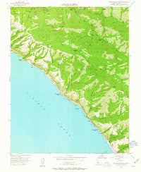
~ Partington Ridge CA topo map, 1:24000 scale, 7.5 X 7.5 Minute, Historical, 1956, updated 1963
Partington Ridge, California, USGS topographic map dated 1956.
Includes geographic coordinates (latitude and longitude). This topographic map is suitable for hiking, camping, and exploring, or framing it as a wall map.
Printed on-demand using high resolution imagery, on heavy weight and acid free paper, or alternatively on a variety of synthetic materials.
Topos available on paper, Waterproof, Poly, or Tyvek. Usually shipping rolled, unless combined with other folded maps in one order.
- Product Number: USGS-5520431
- Free digital map download (high-resolution, GeoPDF): Partington Ridge, California (file size: 12 MB)
- Map Size: please refer to the dimensions of the GeoPDF map above
- Weight (paper map): ca. 55 grams
- Map Type: POD USGS Topographic Map
- Map Series: HTMC
- Map Verison: Historical
- Cell ID: 34329
- Scan ID: 293971
- Imprint Year: 1963
- Woodland Tint: Yes
- Aerial Photo Year: 1954
- Field Check Year: 1956
- Datum: NAD27
- Map Projection: Polyconic
- Map published by United States Geological Survey
- Map Language: English
- Scanner Resolution: 600 dpi
- Map Cell Name: Partington Ridge
- Grid size: 7.5 X 7.5 Minute
- Date on map: 1956
- Map Scale: 1:24000
- Geographical region: California, United States
Neighboring Maps:
All neighboring USGS topo maps are available for sale online at a variety of scales.
Spatial coverage:
Topo map Partington Ridge, California, covers the geographical area associated the following places:
- McWay Falls - Partington Creek - Mocho Creek - Barlow Flat Camp - Anderson Canyon - Overlook Trail - Sykes Camp - Partington Point - Pick Creek - South Fork Rustic Campsite - Lafler Canyon - Michaels Hill - Tan Bark Trail - Logwood Ridge - McWay Cove - Seaview School - Buck Creek - Rainbow Camp - Outlaw Camp - Redwood Creek - Julia Pfeiffer Burns State Park - The California Sea Otter State Game Refuge - Big Sur Division - Partington Cove - Torre Canyon - Marble Peak - Partington Ridge - Saddle Rock - Lafler Rock - North Fork Big Sur River - Grimes Point - Cold Spring Camp - Big Sur Volunteer Fire Brigade Station 2 - Mocho Camp - South Fork Big Sur River - Cienega Camp - Mount Olmstead - Cienega Creek - Partington Canyon - Cold Spring - McWay Canyon - Big Sur Trail - Logwood Campground - Burns Creek - Julia Pfeiffer Burns Underwater Area - Anderson Landing - McWay Creek - Terrace Creek Camp - Terrace Creek - Ewoldsen Trail - Grimes Canyon - Anderson Peak - Waterfall Trail - Timber Top - McWay Rocks - Anderson Creek - Logwood Creek
- Map Area ID: AREA36.2536.125-121.75-121.625
- Northwest corner Lat/Long code: USGSNW36.25-121.75
- Northeast corner Lat/Long code: USGSNE36.25-121.625
- Southwest corner Lat/Long code: USGSSW36.125-121.75
- Southeast corner Lat/Long code: USGSSE36.125-121.625
- Northern map edge Latitude: 36.25
- Southern map edge Latitude: 36.125
- Western map edge Longitude: -121.75
- Eastern map edge Longitude: -121.625


